White Cloud in Doniphan County, Kansas — The American Midwest (Upper Plains)
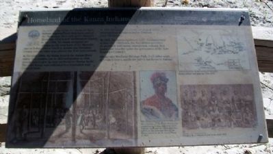
Homeland of the Kanza Indians
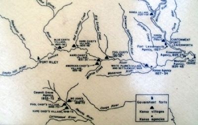
As early as the 1600s, the Kanza (or Kaw) Indians migrated from their home east of the Mississippi River and up the Missouri River into what is now northeastern Kansas. In the 1700s, the Kanza occupied two villages on the west bank of the Missouri: one on Independence Creek in present-day Doniphan County and the other near present-day Fort Leavenworth.
In the early 1800s, the Kanza lived in the Kansas River valley. Two treaties, one in 1825 and another in 1846, forced them to give up their northeastern Kansas lands. The 1,600 Kanza were relocated to a reservation near Council Grove.
In 1873, the Kanza, for whom the state is named, were removed from Kansas to Indian Territory (now Oklahoma).
By 2003, the Kanza numbered 2,647. Headquartered in Kaw City, Oklahoma, the Kaw Nation provides its members with social, educational, cultural, and health care benefits under the governance of the Kaw Executive Council.
Allegawaho Memorial Heritage Park, 3 1/2 miles south of Council Grove, marks the tribe's last home in Kansas.
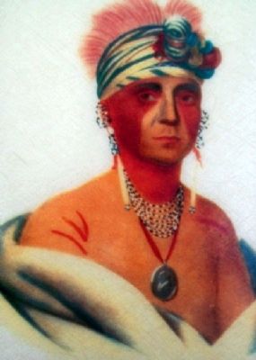
[Kaw Chief painting caption reads] Mon-Chonsia, or The White Plume, was recognized by Indian Superintendent William Clark and the Office of Indian Affairs as the principal chief of the Kanza nation in the St. Louis Treaty of 1825.
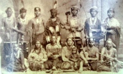
[Photo caption reads] Group of Kaw Indians in full dress, circa 1870.
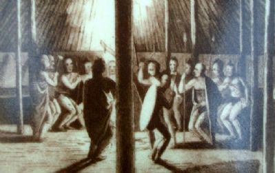
[Background illustration caption reads] "Dog Dance" in a Kanza lodge at Blue Earth Village...
[Map caption reads] Kanza villages and agencies, 1724-1873.
Erected by National Park Service and Kansas Lewis and Clark Bicentennial Commission.
Topics. This historical marker is listed in these topic lists: Exploration • Native Americans. A significant historical year for this entry is 1825.
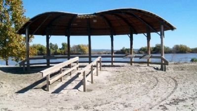
Location. 39° 58.711′ N, 95° 17.641′ W. Marker is in White Cloud, Kansas, in Doniphan County. Marker is on State Highway 7 near Main Street, on the right when traveling north. Marker is under the pavilion in the riverfront park. Touch for map. Marker is in this post office area: White Cloud KS 66094, United States of America. Touch for directions.
Other nearby markers. At least 8 other markers are within 9 miles of this marker, measured as the crow flies. "the water…contains a half…Glass of ooze" (here, next to this marker); The Lewis and Clark Expedition (a few steps from this marker); July 10, 1804 (within shouting distance of this marker); Wilbur Chapman (about 700 feet away, measured in a direct line); "abounds with Beaver" (approx. 7.7 miles away); Louisiana Purchase / Lewis and Clark Expedition / They Passed This Way / Old Trail Road (approx. 8 miles away in Missouri); Holt County
(approx. 8 miles away in Missouri); Irvin Hall (approx. 8.3 miles away). Touch for a list and map of all markers in White Cloud.
More about this marker. The marker was underwater for an extended period in the summer/fall of 2011 due to severe flooding caused by record winter snowfall and record late-May rain far upriver.
Regarding Homeland of the Kanza Indians. Detail photos copied from an identical marker in Atchison, Kansas.
Also see . . .
1. The Kaw Nation. (Submitted on June 3, 2012, by William Fischer, Jr. of Scranton, Pennsylvania.)
2. History of the Kaw Nation. (Submitted on June 3, 2012, by William Fischer, Jr. of Scranton, Pennsylvania.)
3. Allegawaho Heritage Memorial Park. (Submitted on June 3, 2012, by William Fischer, Jr. of Scranton, Pennsylvania.)
4. Kaw Mission State Historic Site. (Submitted on June 3, 2012, by William Fischer, Jr. of Scranton, Pennsylvania.)
Credits. This page was last revised on June 16, 2016. It was originally submitted on June 3, 2012, by William Fischer, Jr. of Scranton, Pennsylvania. This page has been viewed 486 times since then and 12 times this year. Photos: 1, 2. submitted on June 3, 2012, by William Fischer, Jr. of Scranton, Pennsylvania. 3, 4, 5, 6, 7. submitted on July 20, 2011, by William Fischer, Jr. of Scranton, Pennsylvania.
