Near Wathena in Doniphan County, Kansas — The American Midwest (Upper Plains)
"Espyd. a wolf"
Photographed by William Fischer, Jr., October 1, 2011
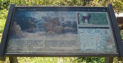
1. "Espyd. a wolf" Marker
"…towards the Evening a many Espyd. a wolf lying a Sleep with the Noise of the Oars Racing he awoke Stood to know what was a comeing…"
Sergeant Joseph Whitehouse
July 7, 1804
The Corps of Discovery, a United States Army expedition lead by Captains Meriwether Lewis and William Clark passed through this area on July 7, 1804. He also described passing by a small island and noted the color of the bluffs as a yellowish color. Captain Clark wrote in his journal of the men killing a wolf that day.
The amount of game that was shot by the expedition was noted beacuse [sic] the meat was an important part of the men's diet and was a valuable commodity. Clark wrote that it required 4 deer or elk, or one buffalo, to supply the expedition members with meals for 24 hours.
[Background illustration caption reads]
Nodaway Island, where the expedition passed by, may have looked something similar to this. Artist Karl Bodmer traveled through this area seventeen years after the expedition. [Image] Courtesy of Joslyn Art Museum, Omaha, NE.
Wolves were once found in present day Kansas but are no longer in the area.
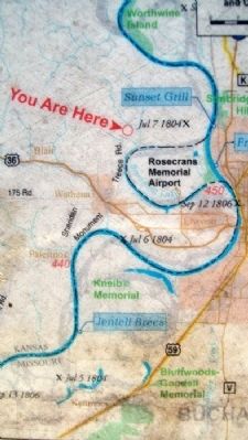
[Map] July 7, 1804
this page online
Erected by National Park Service and Kansas Lewis and Clark Bicentennial Commission.
Topics and series. This historical marker is listed in these topic lists: Animals • Exploration • Waterways & Vessels. In addition, it is included in the Lewis & Clark Expedition series list. A significant historical month for this entry is July 1941.
Location. 39° 48.343′ N, 94° 55.898′ W. Marker is near Wathena, Kansas, in Doniphan County. It is on Treece Road 0.4 miles north of Toulon Road, on the right when traveling north. Marker is along a roadside pullout. Touch for map. Marker is in this post office area: Wathena KS 66090, United States of America. Touch for directions.

Regionally, this marker is in Eastern Kansas. It is also in the American Midwest, in the Lewis & Clark Corridor, in the Corn Belt, on the prairies, and on the Southern Plains. Globally, it is in North America, the Western Hemisphere, the Western World, and the Anglosphere. Historically, it finds itself in what was once the Louisiana Purchase.
Other nearby markers. At least 8 other markers are within 5 miles of this marker, measured as
Photographed by William Fischer, Jr., October 1, 2011
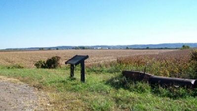
2. "Espyd. a wolf" Marker
Also see . . .
1. Lewis and Clark National Historic Trail. National Park Service entry. (Submitted on June 3, 2012, by William Fischer, Jr. of Reynoldsburg, Ohio.)
2. Lewis and Clark Expedition. National Geographic Kids entry (Submitted on June 3, 2012, by William Fischer, Jr. of Reynoldsburg, Ohio.)
3. Discovering Lewis and Clark. Site homepage (Submitted on June 3, 2012, by William Fischer, Jr. of Reynoldsburg, Ohio.)
4. The Journals of the Lewis and Clark Expedition. Site homepage (Submitted on June 3, 2012, by William Fischer, Jr. of Reynoldsburg, Ohio.)
Photographed by William Fischer, Jr., October 1, 2011
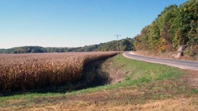
3. View southwest from "Espyd. a wolf" Marker
Photographed by National Park Service, undated
4. Map on "Espyd. a wolf" Marker
Credits. This page was last revised on January 15, 2021. It was originally submitted on June 3, 2012, by William Fischer, Jr. of Reynoldsburg, Ohio. This page has been viewed 889 times since then and 51 times this year. Photos: 1, 2, 3, 4. submitted on June 3, 2012, by William Fischer, Jr. of Reynoldsburg, Ohio.
