Near Fredericksburg in Spotsylvania County, Virginia — The American South (Mid-Atlantic)
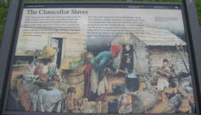
The Chancellor Slaves
The Battle of Chancellorsville
| — | Fredericksburg and Spotsylvania National Military Park | — |
Photographed by Craig Swain, November 10, 2007
1. The Chancellor Slaves Marker
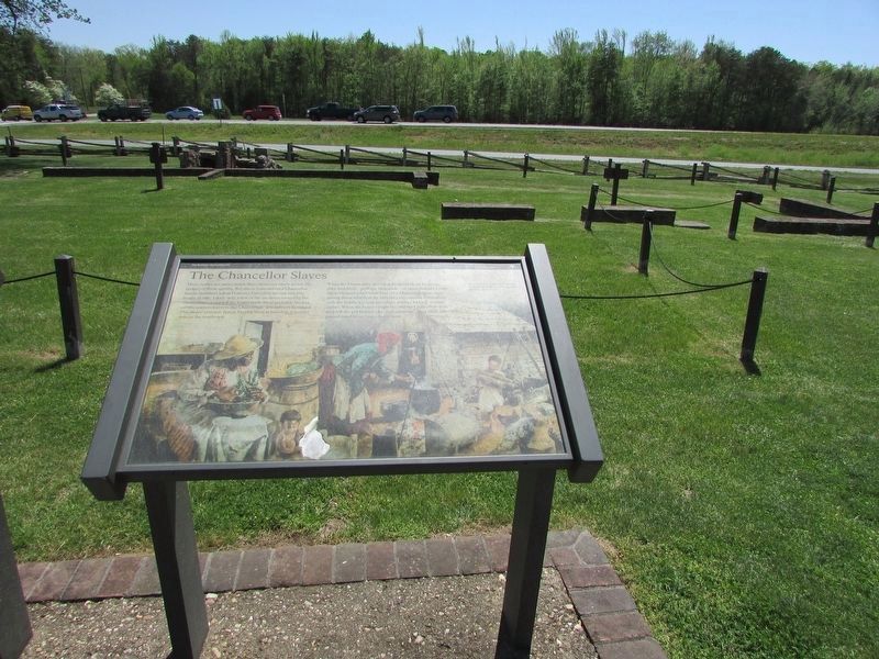
Their names are unrecorded, their labors are rarely noted. No images of them survive. But slaves outnumbered Chancellor family members when Frances Chancellor moved into this house in 1861. Likely only a few of the 20 slaves owned by the Chancellors occupied the house itself. Most probably lived in cabins scattered across the Chancellors' 300 acres of farmland. The slaves' overseer James Moxley lived at Fairview, a quarter mile to the southwest.
When the Union army arrived at Fredericksburg in spring 1862, hundreds - perhaps thousands - of Spotsylvania's 6,000 slaves escaped into Union lines. The Chancellor slaves were among those who fled. By May 1863 only one slave remained with the family: a young girl whose mother had left months earlier. When the house caught fire and the Chancellors fled, they left the girl behind - her fate unknown. Most likely she passed into Union lines - to freedom.
Erected by National Park Service, U.S. Department of the Interior.
Topics. This historical marker is listed in these topic lists: African Americans • War, US Civil. A significant historical month for this entry is May 1863.
Location. 38° 18.527′ N,
this page online

Regionally, this marker is in the Washington Metropolitan Area, in Northern Virginia, and in the Piedmont. It is also in the American South, specifically in the Upper South, in the Mid-Atlantic, and on the Eastern Seaboard. Globally, it is in the North Atlantic Region, North America, the Western Hemisphere, the Western World, and the Anglosphere. Historically, it finds itself in what was once the territory of the Mississippian Culture, one of the original Thirteen Colonies, one of the Confederate States of America, and the Antebellum South.
Other nearby markers. At least 8 other markers are within
Photographed by Craig Swain, November 10, 2007
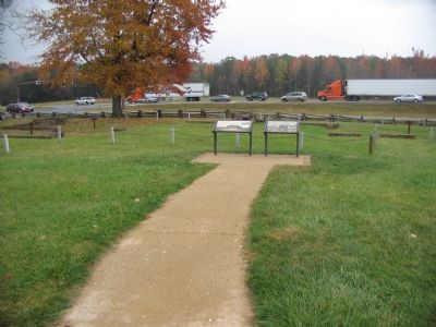
2. Markers Beside the Chancellorsville Inn Ruins
Other markers no longer nearby. Chancellorsville Home of Mrs. Sanford Chancellor (was here, next to this marker but has been permanently removed); Battle of Chancellorsville (was within shouting distance of this marker but has been permanently removed); Chancellorsville (was within shouting distance of this marker but has been permanently removed); a different marker also named Battle of Chancellorsville (was about 300 feet away, measured in a direct line but has been replaced with another marker now near it).
More about this marker.
Photographed by Bill Coughlin, April 18, 2023
3. The Chancellor Slaves Marker
Regarding The Chancellor Slaves. This is one of several markers for the Battle of Chancellorsville at the Chancellorsville Intersection, scene of considerable fighting in the battle. See the Chancellorsville Intersection Virtual Tour by Markers in the links section for a listing of related markers on the tour.
Also see . . . Chancellorsville Intersection Virtual Tour by Markers. The Chancellorsville Intersection portion of the battlefield (stop three on the driving tour of the battlefield) includes markers at the intersection of the historic Plank and Ely's Ford Roads. Considerable fighting occurred here on May 3, 1863. (Submitted on December 8, 2007, by Craig Swain of Leesburg, Virginia.)
Additional keywords. slavery, forced labor
Photographed by Craig Swain, November 10, 2007
4. Burial Site
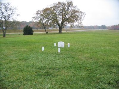
Near the marker is this tombstone marked:
Burial Site of Two Rowley Infants
CA. 1912 and 1915.
Burial Site of Two Rowley Infants
CA. 1912 and 1915.
Credits. This page was last revised on January 22, 2026. It was originally submitted on November 29, 2007, by Craig Swain of Leesburg, Virginia. This page has been viewed 2,386 times since then and 56 times this year. Last updated on February 22, 2008, by Christopher Busta-Peck of Shaker Heights, Ohio. Photos: 1, 2. submitted on November 29, 2007, by Craig Swain of Leesburg, Virginia. 3. submitted on April 24, 2023, by Bill Coughlin of Woodland Park, New Jersey. 4. submitted on November 29, 2007, by Craig Swain of Leesburg, Virginia.
