Marker Logo HMdb.org THE HISTORICAL
MARKER DATABASE
“Bite-Size Bits of Local, National, and Global History”
Old Dominion in Arlington in Arlington County, Virginia — The American South (Mid-Atlantic)
 

Wunder's Crossroads


Wunder's Crossroads Marker image. Click for full size.
Photographed By J. Makali Bruton, October 1, 2017
1. Wunder's Crossroads Marker
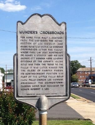
Inscription. For more than half a century from the mid-1800’s the intersection of Lee Highway and Glebe Road was known as Wunders Crossroads after the family whose farm lay just northeast. Dr. Henry S. Wunder and his son George O. Wunder were leading citizens of the county. Glebe Road was then the “road to the falls.” It was later named for the glebe of Fairfax parish. Its northernmost portion was part of the Little Falls Road from Falls Church. Lee Highway, originally the Georgetown-Fairfax Road was renamed to honor Robert E. Lee.
 
Erected by Arlington County, Virginia. (Marker Number 33.)
 
Topics. This historical marker is listed in this topic list: Roads & Vehicles.
 
Location. 38° 53.91′ N, 77° 7.45′ W. Marker is in Arlington, Virginia, in Arlington County. It is in Old Dominion. Marker is on North Glebe Road (Virginia Route 120) north of Langston Boulevard (U.S. 29), on the right when traveling north. Touch for map. Marker is in this post office area: Arlington VA 22207, United States of America. Touch for directions.
 
Other nearby markers. At least 8 other markers are within walking distance of this marker. Birchwood (approx. half a mile away); Hall's Hill Wall (approx. half a mile away); The Glebe of Fairfax Parish (approx. 0.6 miles away); Taking Action: E. Leslie Hamm, Jr.
Paid Advertisement
Click on the ad for more information.
Please report objectionable advertising to the Editor.
Click or scan to see
this page online
(approx. 0.7 miles away); Take Action! (approx. 0.7 miles away); Taking Action: Michael Jones, Gloria Thompson, Ronald Deskins, Lance Newman (approx. 0.7 miles away); Taking Action: Barbara Johns (approx. 0.7 miles away); Taking Action: Dorothy M. Bigelow Hamm (approx. 0.7 miles away). Touch for a list and map of all markers in Arlington.
 
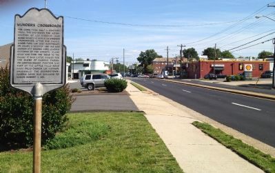
Wunder's Crossroads Marker image. Click for full size.
Photographed By Kevin Vincent, June 9, 2012
2. Wunder's Crossroads Marker
Wunder's Crossroads image. Click for full size.
Photographed By Kevin Vincent, June 9, 2012
3. Wunder's Crossroads
Looking south down Glebe Road to the intersection with Lee Highway.
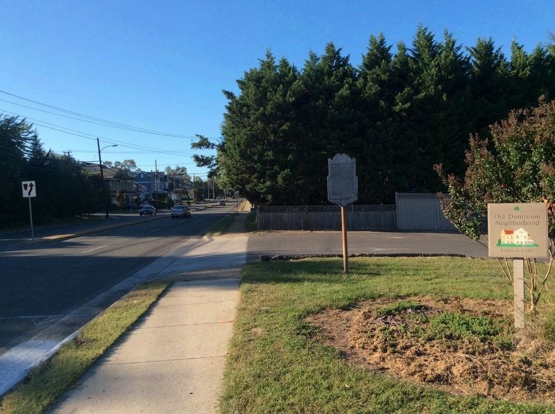
Wunder's Crossroads Marker image. Click for full size.
Photographed By J. Makali Bruton, October 1, 2017
4. Wunder's Crossroads Marker
This view is towards the north on North Glebe Road.
 
 
Credits. This page was last revised on February 1, 2023. It was originally submitted on June 10, 2012, by Kevin Vincent of Arlington, Virginia. This page has been viewed 694 times since then and 24 times this year. Photos:   1. submitted on October 2, 2017, by J. Makali Bruton of Accra, Ghana.   2, 3. submitted on June 10, 2012, by Kevin Vincent of Arlington, Virginia.   4. submitted on October 2, 2017, by J. Makali Bruton of Accra, Ghana. • Bernard Fisher was the editor who published this page.

Share this page.  
Share on Tumblr
m=56255

CeraNet Cloud Computing sponsors the Historical Marker Database.
This website earns income from purchases you make after using our links to Amazon.com. We appreciate your support.
Paid Advertisement
Apr. 25, 2024