Ashton Heights in Arlington in Arlington County, Virginia — The American South (Mid-Atlantic)
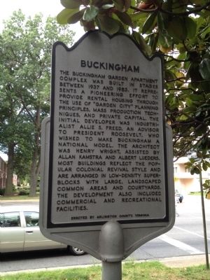
Buckingham
Photographed by Kevin Vincent, June 16, 2012
1. Buckingham Marker
Erected by Arlington County, Virginia.
Topics. This historical marker is listed in these topic lists: Architecture • Industry & Commerce • Parks & Recreational Areas • Settlements & Settlers. A significant historical year for this entry is 1937.
Location. 38° 52.564′ N, 77° 6.483′ W. Marker is in Arlington, Virginia, in Arlington County. It is in Ashton Heights. It is at the intersection of North Glebe Road (Virginia Route 120)
this page online

Regionally, this marker is in the Washington Metropolitan Area and in Northern Virginia. It is also in the American South, specifically in the Upper South, in the Mid-Atlantic, and on the Eastern Seaboard. Globally, it is in the North Atlantic Region, North America, the Western Hemisphere, the Western World, and the Anglosphere. Historically, it finds itself in what was once the territory of the Mississippian Culture, one of the original Thirteen Colonies, one of the Confederate States of America, and the Antebellum South.
Other nearby markers. At least 8 other markers are within walking distance of this marker: Wright Park (approx. 0.3 miles away); Korean War Memorial (approx. 0.4 miles away); Ball's Crossroads (approx. 0.4 miles away); Welburn Square (approx. 0.4 miles away); Ballston (approx. half a mile away); Ellen Bozman (approx. half a mile away); Robert Ball Sr. Family Burial Ground (approx. half a mile away); Human Rights
Photographed by Kevin Vincent, June 16, 2012
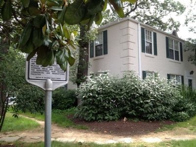
2. Apartment Building Adjacent To Marker
More about this marker. Buckingham is on the National Register of Historic Places and is a designated Arlington historical district.
Photographed by Kevin Vincent, June 16, 2012
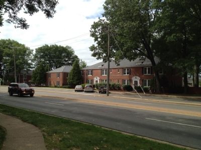
3. Buckingham apartments
View of apartments across Glebe Road from the marker
Credits. This page was last revised on February 1, 2023. It was originally submitted on June 17, 2012, by Kevin Vincent of Arlington, Virginia. This page has been viewed 947 times since then and 22 times this year. Photos: 1, 2, 3. submitted on June 17, 2012, by Kevin Vincent of Arlington, Virginia. • Bernard Fisher was the editor who published this page.
