Mechanicsville in Hanover County, Virginia — The American South (Mid-Atlantic)
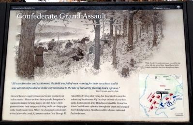
Confederate Grand Assault
John E. Stewart, 44th New York
General James Longstreet received orders to attack just before sunset. Almost as if on dress parade, Longstreet’s regiments started forward across an open field. Union gunners found their range; exploding shells tore huge gaps in the Confederate lines. When the charging Confederates arrived above the creek, 8,000 men under Gen. George W. Morell fired volley after volley, but they failed to stop the advancing Southerners. Up the slope in front of you they came. Just moments after Hood penetrated the Union line these Confederates splashed through the creek and charged the Federal position. Northern soldiers broke ranks and fled to the rear.
While Hood’s Confederates raced toward the top of the hill, the men of Gen. Daniel Butterfield’s brigade fought for their lives along these slopes.
Erected 2011 by Richmond National Battlefield Park.
Topics. This historical marker is listed in this topic list: War, US Civil.
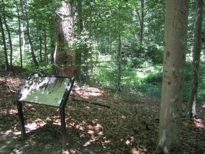
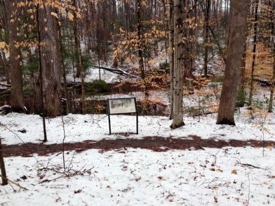
Location. 37° 34.473′ N, 77° 17.624′ W. Marker is in Mechanicsville, Virginia, in Hanover County. Marker can be reached from Watt House Road (Virginia Route 718) 0.7 miles south of Cold Harbor Road (Virginia Route 156). Located in the Gaines' Mill Battlefield unit of Richmond National Battlefield Park. Touch for map. Marker is at or near this postal address: 6283 Watt House Road, Mechanicsville VA 23111, United States of America. Touch for directions.
Other nearby markers. At least 8 other markers are within walking distance of this marker. The Union Left Flank (a few steps from this marker); The Decisive Moment (within shouting distance of this marker); Hood's Attack (within shouting distance of this marker); Pickett’s Brigade, CSA (within shouting distance of this marker); Whiting's Advance (within shouting distance of this marker); The Battle Begins (about 300 feet away, measured in a direct line); The Federal Collapse (about 500 feet away); Powerful Position (about 500 feet away). Touch for a list and map of all markers in Mechanicsville.
Also see . . .
1. Richmond National BattlefieldPark. (Submitted on June 17, 2012, by Bernard Fisher of Richmond, Virginia.)
2. Gaines' Mill. CWSAC Battle Summary (Submitted on June 17, 2012, by Bernard Fisher of Richmond, Virginia.)
3. Gaines' Mill. Richmond Battlefields Association (Submitted on June 17, 2012, by Bernard Fisher of Richmond, Virginia.)
Credits. This page was last revised on June 16, 2016. It was originally submitted on June 17, 2012, by Bernard Fisher of Richmond, Virginia. This page has been viewed 735 times since then and 9 times this year. Photos: 1. submitted on April 8, 2014. 2. submitted on June 17, 2012, by Bernard Fisher of Richmond, Virginia. 3. submitted on April 8, 2014.


