Yonges Island in Meggett in Charleston County, South Carolina — The American South (South Atlantic)
Plainsfield Plantation
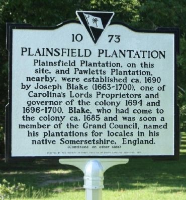
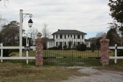
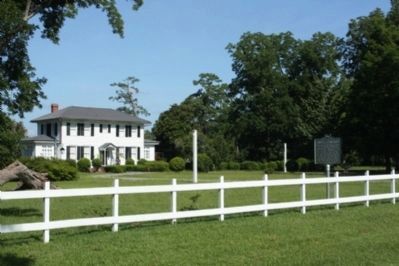
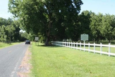
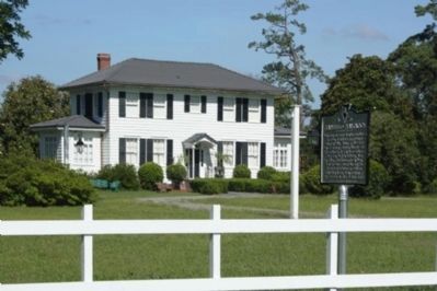
Plainsfield Plantation, on this site, and Pawletts Plantation, nearby, were established ca. 1690 by Joseph Blake (1663-1700), one of Carolina’s Lords Proprietors and governor of the colony 1694 and 1696-1700. Blake, who had come to the colony ca. 1685 and was soon a member of the Grand Council, named his plantations for locales in his native Somersetshire, England.
(Reverse text)
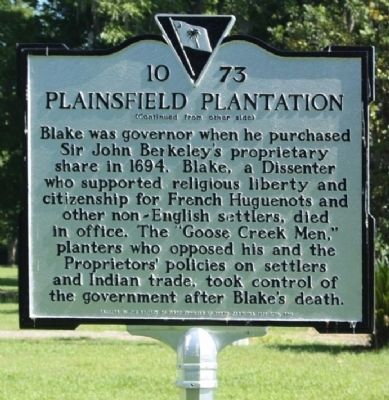
Blake was governor when he purchased Sir John Berkeley’s proprietary share in 1694. Blake, a Dissenter who supported religious liberty and citizenship for French Huguenots and other non-English settlers, died in office. The “Goose Creek Men,” planters who opposed his and the Proprietors’ policies on settlers and Indian trade, took control of the government after Blake’s death.
Erected 2012 by The Society of First Families of South Carolina 1670-1700. (Marker Number 10-73.)
Topics. This historical marker is listed in these topic lists: Colonial Era • Settlements & Settlers. A significant historical year for this entry is 1690.
Location. 32° 43.239′ N, 80° 11.075′ W. Marker is in Meggett, South Carolina, in Charleston County. It is on Yonges Island. Marker is on Towles Road (State Highway 10-92 ), on the right when traveling south. Located near the southern terminus of Towles Road. Touch for map. Marker is at or near this postal address: 4611 Towles Road, Hollywood SC 29449, United States of America. Touch for directions.
Other nearby markers. At least 8 other markers are within 10 miles of this marker, measured as the crow flies. St. Paul's, Stono / St. Paul's Churchyard (approx. 1.9 miles away); Champneys' Pink Cluster (approx. 4˝ miles away); The Stono Rebellion (approx. 5 miles away); Belvidere School Site (approx. 5.1 miles away); Grave Of Colonel William A. Washington (approx. 5.9 miles away); John's Island Presbyterian Church (approx. 6.4 miles away); The Progressive Club (approx. 8.9 miles away); Federal Expedition on John's Island / Battle of Burden's Causeway (approx. 9˝ miles away).
Regarding Plainsfield Plantation. Governor Joseph Blake
was Governor of South Carolina in 1694 and 1696 - 1700, and was a nephew of Admiral Robert Blake (1599 - 1657)
He resided at South Carolina at his "Plainsfield" plantation on the Stono River, near "New Cut", which was probably named after Plainsfield camp, a historical area near Bridgwater, Somerset, England, where he spent his youth. His father emigrated to South Carolina in 1682, and in 1683 Joseph contributed some of his fortune to help a large group of dissenters emigrate from Somerset, England to Charleston, South Carolina. This is about the same time that John Fripp is said to have arrived in South Carolina, so perhaps he was among this group of dissenters. Bridgwater is only 30 miles West of where the nucleus of UK Fripp's resided.
Joseph's sister was the wife of Governor Morton, and the mother of Joseph Morton.
(notes from: The Fripp family of South Carolina)
Also see . . . The Province of Carolina. Wikipedia entry:
"...The Lords Proprietors, operating under their royal charter, were able to exercise their authority with nearly the independence of the king himself. The actual government consisted of a governor, a powerful council, on which half of the councillors were appointed by the Lords Proprietors themselves, and a relatively weak, popularly elected assembly..." (Submitted on June 20, 2012, by Mike Stroud of Bluffton, South Carolina.)
Additional commentary.
1. Marker
Although printed and casted as 2011, marker was erected in 2012
— Submitted June 19, 2012, by Mike Stroud of Bluffton, South Carolina.
Credits. This page was last revised on February 16, 2023. It was originally submitted on June 19, 2012, by Mike Stroud of Bluffton, South Carolina. This page has been viewed 2,095 times since then and 109 times this year. Photos: 1, 2, 3. submitted on June 19, 2012, by Mike Stroud of Bluffton, South Carolina. 4, 5, 6. submitted on June 20, 2012, by Mike Stroud of Bluffton, South Carolina.
