Near Charlotte in Atascosa County, Texas — The American South (West South Central)
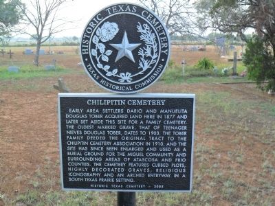
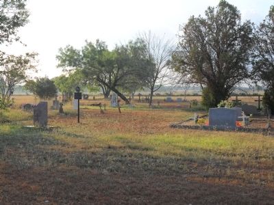
Chilipitin Cemetery
Erected 2005 by Texas Historical Commission. (Marker Number 13619.)
Topics. This historical marker is listed in this topic list: Cemeteries & Burial Sites. A significant historical year for this entry is 1877.
Location. 28° 51.758′ N, 98° 47.502′ W. Marker is near Charlotte, Texas, in Atascosa County. Marker is on County Road 315W, 0.2 miles east of Farm to Market Road 140, on the right when traveling east. Touch for map. Marker is in this post office area: Charlotte TX 78011, United States of America. Touch for directions.
Other nearby markers. At least 8 other markers are within 15 miles of this marker, measured as the crow flies. Kings Highway Camino Real — Old San Antonio Road (approx. 6.3 miles away); a different marker also named Kings Highway Camino Real — Old San Antonio Road (approx. 6.4 miles away); a different marker also named Kings Highway Camino Real — Old San Antonio Road (approx. 12.4 miles away); a different marker also named Kings Highway Camino Real — Old San Antonio Road (approx. 13.2 miles away); Amphion and Amphion Cemetery (approx. 13˝ miles away); Here William Alexander A. Wallace (approx. 13.6 miles away); Sand Branch Baptist Church (approx. 13.9 miles away); Site of Jose Antonio Navarro Ranch Headquarters (approx. 15.1 miles away). Touch for a list and map of all markers in Charlotte.
Credits. This page was last revised on June 16, 2016. It was originally submitted on June 22, 2012, by John A Hensarling of Campbellton, Texas. This page has been viewed 1,258 times since then and 60 times this year. Photos: 1, 2. submitted on July 3, 2012, by John A Hensarling of Campbellton, Texas. • Bernard Fisher was the editor who published this page.

