Sloatsburg in Rockland County, New York — The American Northeast (Mid-Atlantic)
Ramapo Valley
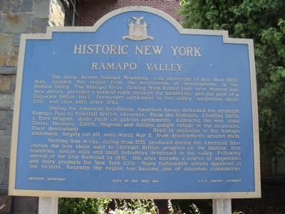
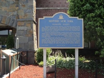
Historic New York
The steep, barren Ramapo Mountains, with elevations of less than 1300 feet, isolated this region from the mainstream of developments in the Hudson Valley. The Ramapo River, flowing from Round Lake near Monroe into New Jersey, provided a natural route through the mountains, and the path of a Delaware Indian trail. Permanent settlement in the valley, beginning about 1710, was slow until after 1740.
During the American Revolution, American forces defended the strategic Ramapo Pass to forestall British advances. From the Ramapos, Claudius Smith, a Tory brigand, made raids on patriot settlements. Following the war, some Tories, Hessians, Dutch, Negroes and Indians sought refuge in the mountains. Their descendants lived in seclusion in the Ramapo wilderness, largely cut off, until World War II, from developments around them.
Sterling Iron Works, dating from 1751, produced during the American Revolution the iron chain used to obstruct British progress up the Hudson. Iron foundries, cotton mills and small industries developed in the valley. Following arrival of the Erie Railroad in 1841, the area became a source of vegetables and dairy products for New York City. Many fashionable estates appeared in the vicinity. Recently the region has become one of suburban communities.
Erected 1963 by State of New York Education Department, N.Y.S. Thruway Authority.
Topics and series. This historical marker is listed in these topic lists: Colonial Era • War, US Revolutionary. In addition, it is included in the Historic New York State series list. A significant historical year for this entry is 1300.
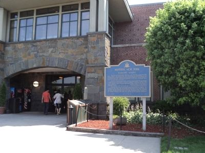
Location. 41° 9.071′ N, 74° 11.31′ W. Marker is in Sloatsburg, New York, in Rockland County. Marker is on New York State Thruway (Interstate 87), on the right when traveling north. Marker is located in the Sloatsburg Travel Plaza on the New York State Thruway. Touch for map. Marker is in this post office area: Sloatsburg NY 10974, United States of America. Touch for directions.
Other nearby markers. At least 8 other markers are within 3 miles of this marker, measured as the crow flies. Sloat House & Inn (approx. 0.3 miles away); Sloatsburg Cemetery (approx. 0.4 miles away); The Glenwood Hotel (approx. half a mile away); Torne Brook Farm (approx. 1.4 miles away); Thurgood Marshall and the Hillburn Schools (approx. 2.1 miles away); Suffern's Depot, 1841-1941 (approx. 2.9 miles away); Ben Walker / Vincenzo "Vinny" Tamburro (approx. 3 miles away); Suffern Grammar School (approx. 3 miles away). Touch for a list and map of all markers in Sloatsburg.
Credits. This page was last revised on June 16, 2016. It was originally submitted on June 23, 2012, by Bill Coughlin of Woodland Park, New Jersey. This page has been viewed 882 times since then and 35 times this year. Photos: 1, 2, 3. submitted on June 23, 2012, by Bill Coughlin of Woodland Park, New Jersey.


