Elizabeth City in Pasquotank County, North Carolina — The American South (South Atlantic)
Battle of Elizabeth City
“Dash at the Enemy”
— Burnside Expedition —
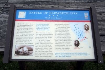
After Union Gen. Ambrose E. Burnside captured Roanoke Island on February 8, 1862, he dispatched Commander Stephen C. Rowan to destroy the Mosquito Fleet, which had been annoying U.S. naval vessels. Confederate Commodore William F. Lynch’s fleet consisted of small, shallow-draft tugs and intracoastal trading steamers converted to gunboats: Appomattox, Beaufort, Black Warrior, Ellis, Fanny, and Seabird. Lynch positioned his vessels a mile east of here, with Black Warrior in Chantilly Bay off the north bank of the Pasquotank River and the other boats lined up across the river to Cobb’s Point, site of a four-gun artillery emplacement.
On February 10, Rowan steamed upriver with a fleet that included USS Ceres and Commodore Perry. Lynch discovered that the Cobb’s Point artilleryists had fled and asked Capt. William H. Parker of CSS Beaufort to man the guns. After firing a volley, Parker discovered to his dismay that cannons had been placed so they could not swivel upstream; after the Federal ships passed by, the guns were useless. He spiked them and withdrew.
Rowan ordered his vessels to “Dash at the enemy.” They shelled Cobb’s Point, then soon sank or disabled the Mosquito Fleet. Commodore Perry rammed and sank Seabird. Ceres captured Ellis. Appomattox, Black Warrior, and Fanny were battered and scuttled or abandoned. Beaufort alone escaped to Norfolk. Having disposed of the Mosquito Fleet, Rowan occupied Elizabeth City, and for the remainder of the war, North Carolina’s coastal rivers remained in Union hands, with the notable exception of the Cape Fear River.
“The Burnside expedition, it did not end in smoke. It captured Elizabeth City, and the isle of Roanoke.” - Unidentified U.S. soldier
“It was one of the best conceived and best executed battles of the war….It was just such a scene as naval officers delight in.” – U.S. Adm. David D. Porter
Erected by North Carolina Civil War Trails.
Topics and series. This historical marker is listed in these topic lists: War, US Civil • Waterways & Vessels. In addition, it is included in the North Carolina Civil War Trails series list. A significant historical month for this entry is February 1791.
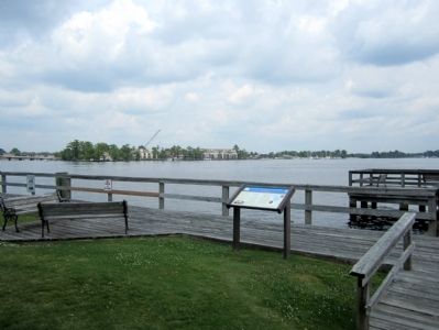
Location. 36° 17.831′ N, 76° 13.074′ W. Marker is in Elizabeth City, North Carolina, in Pasquotank County. Marker can be reached from the intersection of South Water Street and East Ehringhaus Street, on the left when traveling south. Touch for map. Marker is at or near this postal address: 501 S Water St, Elizabeth City NC 27909, United States of America. Touch for directions.
Other nearby markers. At least 8 other markers are within walking distance of this marker. Pasquotank River (here, next to this marker); A Town Divided (a few steps from this marker); Wright Brothers in the Albemarle (a few steps from this marker); J. C. B. Ehringhaus (about 400 feet away, measured in a direct line); Joseph C. Price (about 400 feet away); Culpeper’s Rebellion (about 400 feet away); a different marker also named Wright Brothers in the Albemarle (about 700 feet away); Soybean Processing (approx. 0.2 miles away). Touch for a list and map of all markers in Elizabeth City.
More about this marker. On the lower left is a sketch of the "CSS Seabird"
On the right are portraits of "Commander Stephen C. Rowan" and "Commodore William F. Lynch"
Credits. This page was last revised on October 7, 2021. It was originally submitted on June 26, 2012, by Bernard Fisher of Richmond, Virginia. This page has been viewed 882 times since then and 28 times this year. Photos: 1, 2. submitted on June 26, 2012, by Bernard Fisher of Richmond, Virginia. 3. submitted on June 25, 2012, by Bernard Fisher of Richmond, Virginia.


