Elizabeth City in Pasquotank County, North Carolina — The American South (South Atlantic)
Hugh Cale
1835-1910
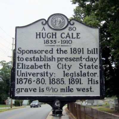
Photographed by Bernard Fisher, June 23, 2012
1. Hugh Cale Marker
Erected 1994 by Division of Archives and History. (Marker Number A-80.)
Topics and series. This historical marker is listed in these topic lists: Cemeteries & Burial Sites • Education. In addition, it is included in the Historically Black Colleges and Universities, and the North Carolina Division of Archives and History series lists. A significant historical year for this entry is 1891.
Location. 36° 17.509′ N, 76° 13.296′ W. Marker is in Elizabeth City, North Carolina, in Pasquotank County. It is at the intersection of South Road Street and Cale Street, on the right when traveling south on South Road Street. Touch for map. Marker is in this post office area: Elizabeth City NC 27909, United States of America. Touch for directions.

Regionally, this marker is in North Carolina’s Coastal Plain. It is also in the American South, specifically in the Upper South, in the Tidewater, and on the Eastern Seaboard. Globally, it is in the North Atlantic Region, North America,
this page online
Other nearby markers. At least 8 other markers are within walking distance of this marker: Shepard / S Road Streets (about 400 feet away, measured in a direct line); Annie E. Jones (approx. ¼ mile away); Museum of the Albemarle Land Acknowledgement (approx. 0.3 miles away); Celebrating 100 years of Women's Right to Vote 1920-2020 (approx. 0.3 miles away); Illegal Liquor in the Albemarle Sound Region (approx. 0.4 miles away); J. C. B. Ehringhaus (approx. 0.4 miles away); Joseph C. Price (approx. 0.4 miles away); Peter Weddick Moore (approx. 0.4 miles away). Touch for a list and map of all markers in Elizabeth City.
Another marker is no longer nearby. Soybean Processing (was approx. 0.4 miles away but has been replaced with another marker now near it).
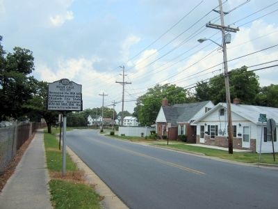
Photographed by Bernard Fisher, June 23, 2012
2. Hugh Cale Marker
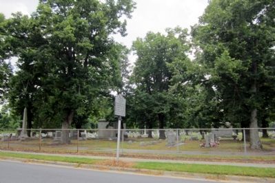
Photographed by Bernard Fisher, June 23, 2012
3. Hollywood Cemetery
Credits. This page was last revised on June 21, 2021. It was originally submitted on June 26, 2012, by Bernard Fisher of Richmond, Virginia. This page has been viewed 616 times since then and 29 times this year. Photos: 1, 2, 3. submitted on June 26, 2012, by Bernard Fisher of Richmond, Virginia.
