Schuylerville in Saratoga County, New York — The American Northeast (Mid-Atlantic)
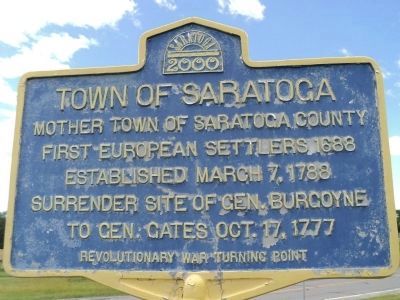
Town of Saratoga
Photographed by Bill Coughlin, June 27, 2012
1. Town of Saratoga Marker
Several markers with this identical text are located throughout Schuylerville.
First European settlers 1688
Established March 7, 1788
Surrender site of Gen. Burgoyne
to Gen. Gates Oct. 17, 1777
Revolutionary War Turning Point
Erected 2000 by Saratoga County.
Topics. This historical marker is listed in these topic lists: Colonial Era • Settlements & Settlers • War, US Revolutionary. A significant historical date for this entry is March 7, 1962.
Location. 43° 6.451′ N, 73° 35.884′ W. Marker is in Schuylerville, New York, in Saratoga County. It is at the intersection of Lake Avenue (New York State Route 29) and County Route 338, on the left when traveling west on Lake Avenue. Marker is located in a grassy triangle at the merger of the roads. Touch for map. Marker is in this post office area: Schuylerville NY 12871, United States of America. Touch for directions.

Regionally, this marker is in Upstate New York, in the Capital District, and in the Albany Metropolitan Area. It is also in the American Northeast and in the Mid-Atlantic. Globally, it is in North America, the Great North Woods, the Western Hemisphere, the Western World, and the Anglosphere. Historically,
this page online
Other nearby markers. At least 8 other markers are within walking distance of this marker: Colonel Morgan (approx. 0.4 miles away); October 10-17, 1777 (approx. 0.6 miles away); Saratoga Monument Association (approx. 0.7 miles away); Major Nathan Goodale (approx. 0.7 miles away); Victory Woods (approx. 0.7 miles away); Saratoga Monument (approx. ¾ mile away); Continental Barracks (approx. 0.9 miles away); Camp of General Burgoyne (approx. 0.9 miles away). Touch for a list and map of all markers in Schuylerville.
Also see . . .
1. Battle of Saratoga. Saratoga County Chamber of Commerce website entry (Submitted on March 12, 2022, by Larry Gertner of New York, New York.)
2. A British perspective on the Battle of Saratoga from BritishBattles.com. (Submitted on June 28, 2012, by Bill Coughlin of Woodland Park, New Jersey.)
Photographed by Bill Coughlin, June 27, 2012
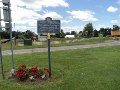
2. Town of Saratoga Marker
Photographed by Bill Coughlin, June 27, 2012
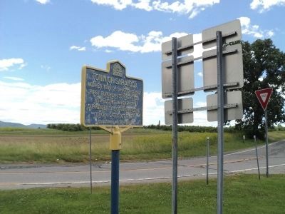
3. Town of Saratoga Marker
The oblisk of the Saratoga Victory monument can be seen to the right of the marker.
Photographed by Bill Coughlin, June 27, 2012
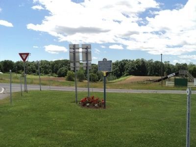
4. Marker in Schuylerville
Credits. This page was last revised on March 12, 2022. It was originally submitted on June 28, 2012, by Bill Coughlin of Woodland Park, New Jersey. This page has been viewed 478 times since then and 19 times this year. Photos: 1, 2, 3, 4. submitted on June 28, 2012, by Bill Coughlin of Woodland Park, New Jersey.
