
Plymouth in Washington County, North Carolina — The American South (South Atlantic)
Ausbon House
Sniper’s Nest
Photographed by Bernard Fisher, June 28, 2012
1. Ausborn House CWT Marker
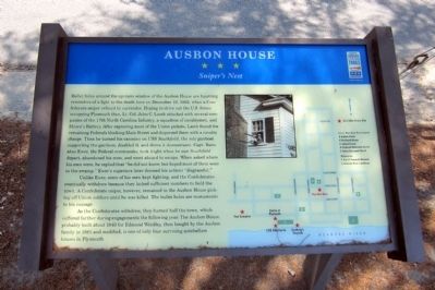
Bullet holes around the upstairs window of the Ausbon House are haunting reminders of a fight to the death here on December 10, 1862, when a Confederate sniper refused to surrender. Hoping to drive out the U.S. forces occupying Plymouth then, Lt. Col. John C. Lamb attacked with several companies of the 17th North Carolina Infantry, a squadron of cavalrymen, and Moore’s Battery. After capturing most of the Union pickets, Lamb found the remaining Federals blocking Main Street and dispersed them with a cavalry charge. Then he turned his cannons on USS Southfield, the sole gunboat supporting the garrison, disabled it, and drove it downstream. Capt. Barnabas Ewer, the Federal commander, took fright when he saw Southfield depart, abandoned his men, and went aboard to escape. When asked where his men were, he replied that “he did not know, but hoped most of them were in the swamp.” Ewer’s superiors later deemed his actions “disgraceful.”
Unlike Ewer, some of his men kept fighting, and the Confederates eventually withdrew because they lacked sufficient numbers to hold the town. A Confederate sniper, however, remained in the
this page online
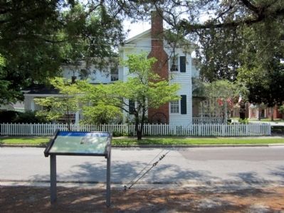
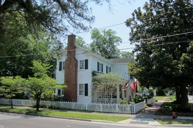
As the Confederates withdrew, they burned half the town, which suffered further during engagements the following year. The Ausbon House, probably built about 1840 for Edmond Windley, then bought by the Ausbon family in 1885 and modified, is one of only four surviving antebellum houses in Plymouth.
Erected by North Carolina Civil War Trails.
Topics and series. This historical marker is listed in this topic list: War, US Civil. In addition, it is included in the North Carolina Civil War Trails series list. A significant historical date for this entry is December 10, 1862.
Location. 35° 51.902′ N, 76° 44.96′ W. Marker is in Plymouth, North Carolina, in Washington County. It is at the intersection of East Third Street and Washington Street, on the left when traveling east on East Third Street. Touch for map. Marker is at or near this postal address: 302 Washington St, Plymouth NC 27962, United States of America. Touch for directions.

Regionally, this marker is in North Carolina’s Coastal Plain. It is also in the American South,

Photographed by Devry Becker Jones (CC0), June 14, 2025
2. Ausbon House Marker
The marker has weathered but remains generally legible.
Other nearby markers. At least 8 other markers are within walking distance of this marker: A different marker also named Battle of Plymouth (within shouting distance of this marker); Plymouth United Methodist Church (about 300 feet away, measured in a direct line); Augustin Daly (about 500 feet away); Hampton Academy (about 600 feet away); a different marker also named Battle of Plymouth (about 600 feet away); Washington County North Carolina Supreme Sacrifice and Veterans Memorial (about 600 feet away); Ram Albemarle (about 600 feet away); Washington County Courthouse (about 700 feet away). Touch for a list and map of all markers in Plymouth.
Other markers no longer nearby. Battle of Plymouth (was within shouting distance
Photographed by Bernard Fisher, June 28, 2012
3. Ausborn House CWT Marker
Also see . . . Visit the Town of Plymouth. (Submitted on March 6, 2021.)
Photographed by Bernard Fisher, June 28, 2012
4. Ausborn House
Credits. This page was last revised on June 22, 2025. It was originally submitted on July 1, 2012, by Bernard Fisher of Richmond, Virginia. This page has been viewed 3,988 times since then and 115 times this year. Photos: 1. submitted on July 1, 2012, by Bernard Fisher of Richmond, Virginia. 2. submitted on June 22, 2025, by Devry Becker Jones of Washington, District of Columbia. 3, 4. submitted on July 1, 2012, by Bernard Fisher of Richmond, Virginia.
