Edenton in Chowan County, North Carolina — The American South (South Atlantic)
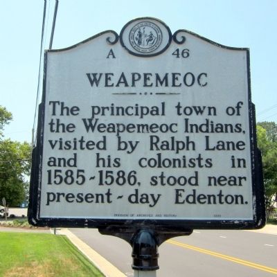
Weapemeoc
Erected 1990 by Division of Archives and History. (Marker Number A-46.)
Topics and series. This historical marker is listed in these topic lists: Colonial Era • Native Americans • Settlements & Settlers. In addition, it is included in the North Carolina Division of Archives and History series list. A significant historical year for this entry is 1585.
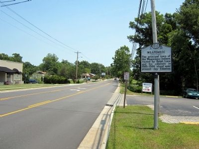
Location. 36° 3.695′ N, 76° 37.04′ W. Marker is in Edenton, North Carolina, in Chowan County. Marker is at the intersection of West Queen Street (Business U.S. 17) and Dickinson Street, on the right when traveling east on West Queen Street. Touch for map. Marker is in this post office area: Edenton NC 27932, United States of America. Touch for directions.
Other nearby markers. At least 8 other markers are within walking distance of this marker. Thomas Child (approx. 0.3 miles away); Mackeys Ferry (approx. 0.4 miles away); James Iredell, Jr (approx. half a mile away); Edenton Tea Party (approx. half a mile away); 1736 St. Paul's Episcopal Church (approx. half a mile away); St. Paul's Episcopal Church (approx. half a mile away); Barker House (approx. half a mile away); Francis Corbin (approx. half a mile away). Touch for a list and map of all markers in Edenton.
Credits. This page was last revised on June 24, 2021. It was originally submitted on July 1, 2012, by Bernard Fisher of Richmond, Virginia. This page has been viewed 622 times since then and 53 times this year. Photos: 1, 2. submitted on July 1, 2012, by Bernard Fisher of Richmond, Virginia.

