Plymouth in Washington County, North Carolina — The American South (South Atlantic)
Hoke's Final Line
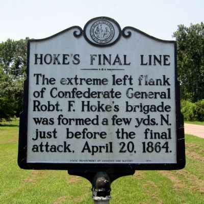
Photographed by Bernard Fisher, June 28, 2012
1. Hoke's Final Line Marker
Erected 1971 by State Department of Archives and History. (Marker Number BBB-4.)
Topics and series. This historical marker is listed in this topic list: War, US Civil. In addition, it is included in the North Carolina Division of Archives and History series list. A significant historical date for this entry is April 20, 1860.
Location. 35° 51.776′ N, 76° 45.512′ W. Marker is in Plymouth, North Carolina, in Washington County. It is at the intersection of West Main Street and Alden Road, on the left when traveling west on West Main Street. Touch for map. Marker is in this post office area: Plymouth NC 27962, United States of America. Touch for directions.

Regionally, this marker is in North Carolina’s Coastal Plain. It is also in the American South, specifically in the Upper South, in the Tidewater, and on the Eastern Seaboard. Globally, it is in the North Atlantic Region, North America, the Western Hemisphere, the Western World, and the Anglosphere. Historically, it finds
this page online
Other nearby markers. At least 8 other markers are within walking distance of this marker: Roanoke River Lighthouse (approx. 0.3 miles away); Why Plymouth? (approx. 0.4 miles away); Plymouth Water Street Landing Park (approx. 0.4 miles away); Plymouth was at the Center of the Underground Railroad in North Carolina (approx. 0.4 miles away); Hampton Academy (approx. half a mile away); Battle of Plymouth (approx. half a mile away); Brick House Landing (approx. half a mile away); Ausbon House (approx. half a mile away). Touch for a list and map of all markers in Plymouth.
Another marker is no longer nearby. Battle of Plymouth (was approx. half a mile away but has been replaced with another marker now near it).
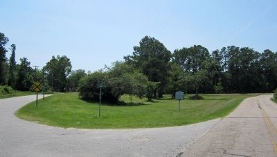
Photographed by Bernard Fisher, June 28, 2012
2. W Main St & Alden Rd
Credits. This page was last revised on June 16, 2016. It was originally submitted on July 1, 2012, by Bernard Fisher of Richmond, Virginia. This page has been viewed 696 times since then and 24 times this year. Photos: 1, 2. submitted on July 1, 2012, by Bernard Fisher of Richmond, Virginia.
