Pigtown in Baltimore, Maryland — The American Northeast (Mid-Atlantic)
Railroads Eclipse a National Road
“Thus will scientific power conquer space.”
— The Historic National Road - The Road That Built The Nation —
Inscription.
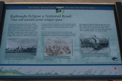
For several decades in the early 1800s, thousands of Conestoga Wagons, “ships of inland commerce,” ruled the National Road. With their sloping bodies, wheels taller than a man and six-horse teams skillfully maneuvered with a single “jerk line,” they could carry up to eight tons of freight. The railroad, a Baltimore-borne transportation revolution, soon put them out of business, along with the taverns, livery stables, wheelwrights, and blacksmiths that served them.
In 1830, the National Road was still under construction when here, from the Roundhouse, the Baltimore & Ohio Railroad introduced the first regular freight and passenger service in the United States. By 1852, the B & O spent $15 million to lay track as far as the Ohio River. Freight and travel time was cut in half. The “national road” was now on rails.
Erected by America's Byways.
Topics and series. This historical marker is listed in these topic lists: Railroads & Streetcars • Roads & Vehicles • Settlements & Settlers. In addition, it is included in the Baltimore and Ohio Railroad (B&O), and the The Historic National Road series lists. A significant historical year for this entry is 1830.
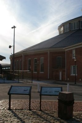
Location. This marker has been replaced by another marker nearby. It was located near 39° 17.117′ N, 76° 37.91′ W. Marker was in Baltimore, Maryland. It was in Pigtown. Marker could be reached from West Pratt Street (U.S. 40). Touch for map. Marker was at or near this postal address: 837 W Pratt St, Baltimore MD 21201, United States of America. Touch for directions.
Other nearby markers. At least 8 other markers are within walking distance of this location. The Underground Railroad (here, next to this marker); The National Road (here, next to this marker); Mount Clare Shops (a few steps from this marker); Site of Old Relay Station and Hotel (within shouting distance of this marker); First Stone of the Balt. & Ohio Rail Road (within shouting distance of this marker); Pullman Troop Sleeper No. 7437 (within shouting distance of this marker); Luther G. Smith (about 300 feet away, measured in a direct line); The Car That Carried Ike on His Last Trip (about 300 feet away). Touch for a list and map of all markers in Baltimore.
More about this marker. Three illustrations span the lower half of the marker. On the left, The giant Conestoga freight wagons, with their jingling teams of heavy horses, were an impressive sight. However they were too slow and cumbersome to compete with railroad cars
In the lower center, In spite of soot and noise, railroad cars were smoother, more comfortable and faster than the old stagecoaches on the National Road
On the
lower right, 19th century Americans declared "go-ahead is our maxim and password" as they opened up the continent. The noisy and dirty steam railroad, called "hell in harness," made that task possible
The background of the marker is "National Road at Fairview Inn" which is the standard for markers in this series. An elevation diagram of the national road is displayed on the bottom of the marker's face.
Credits. This page was last revised on March 23, 2024. It was originally submitted on February 24, 2008, by Christopher Busta-Peck of Shaker Heights, Ohio. This page has been viewed 1,530 times since then and 13 times this year. Photos: 1, 2. submitted on February 24, 2008, by Christopher Busta-Peck of Shaker Heights, Ohio. • Craig Swain was the editor who published this page.

