Near Fairfax in Fairfax County, Virginia — The American South (Mid-Atlantic)
David R. Pinn Community Center
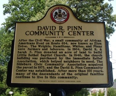
July 7, 2012
1. David R. Pinn Community Center Marker
Erected 2009 by The Fairfax County History Commission.
Topics and series. This historical marker is listed in these topic lists: African Americans • Religion & Religious Structures. In addition, it is included in the Virginia, Fairfax County History Commission series list. A significant historical year for this entry is 1904.
Location. 38° 48.417′ N, 77° 17.955′ W. Marker is near Fairfax, Virginia, in Fairfax County. It is at the intersection of Zion Drive (County Route 654) and Windsor Hills Drive, on
this page online

Regionally, this marker is in the Washington Metropolitan Area and in Northern Virginia. It is also in the American South, specifically in the Upper South, in the Mid-Atlantic, and on the Eastern Seaboard. Globally, it is in the North Atlantic Region, North America, the Western Hemisphere, the Western World, and the Anglosphere. Historically, it finds itself in what was once the territory of the Mississippian Culture, one of the original Thirteen Colonies, one of the Confederate States of America, and the Antebellum South.
Other nearby markers. At least 8 other markers are within 2 miles of this marker, measured as the crow flies: The Huldah Coffer House (approx. 1.1 miles away); World Peace Sand Mandala (approx. 1.4 miles away); The Legend Story of the First Prayer Wheel / Prayer for World Peace and Welfare (approx. 1.4 miles away); Johnson-Sabin Way (approx. 1.4 miles away); Clara H. Barton (approx. 1½ miles away); Veterans Memorial
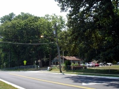
July 7, 2012
2. David R. Pinn Community Center Marker
Also see . . . The Center's History. Fairfax County Website (Submitted on July 7, 2012.)

July 7, 2012
3. David R. Pinn Community Center
Credits. This page was last revised on March 20, 2023. It was originally submitted on July 7, 2012. This page has been viewed 2,226 times since then and 76 times this year. Photos: 1, 2, 3. submitted on July 7, 2012. • Craig Swain was the editor who published this page.
