
Kingston in Ulster County, New York — The American Northeast (Mid-Atlantic)
Hoffman House
Photographed by Bill Coughlin, July 12, 2012
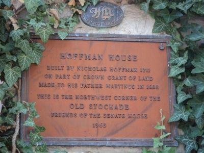
1. Hoffman House Marker
A City of Kingston Designated Landmark marker can be seen above the Hoffman House marker.
on part of Crown Grant of land
made to his father Martinus in 1688.
This is the northwest corner of the
Old Stockade.
Erected 1965 by Friends of the Senate House.
Topics. This historical marker is listed in these topic lists: Colonial Era • Notable Buildings. A significant historical year for this entry is 1711.
Location. 41° 56.098′ N, 74° 1.371′ W. Marker is in Kingston, New York, in Ulster County. It is at the intersection of N Front Street and Green Street, on the left when traveling west on N Front Street. Touch for map. Marker is at or near this postal address: 94 N Front Street, Kingston NY 12401, United States of America. Touch for directions.

Regionally, this marker is in Upstate New York and in the Hudson Valley. It is also in the American Northeast, in the Mid-Atlantic, and on the Eastern Seaboard. Globally, it is in the North Atlantic Region, North America, the Western Hemisphere, the Western World, and the Anglosphere. Historically, it finds itself in what was once New Netherland and also one of the original Thirteen Colonies.
Other nearby markers. At least
this page online
Also see . . . Hoffman House Restaurant and Tavern. Hoffman House website homepage (Submitted on July 13, 2012, by Bill Coughlin of Woodland Park, New Jersey.)

Photographed by Bill Coughlin, July 12, 2012
2. Hoffman House Marker
Photographed by Bill Coughlin, July 12, 2012
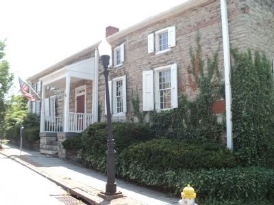
3. Marker in Kingston
The marker is located at the site of the northwest corner of a stockade that was built around the settlement here in 1658 to protect the citizens from the local Indians. The stockade was mostly gone when the British burned the town more than a century later.
Photographed by Bill Coughlin, July 12, 2012
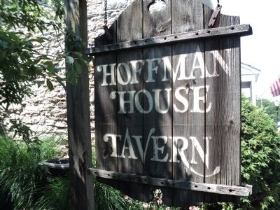
4. Hoffman House
The Hoffman House currently operates as a tavern and is open to the public.
Photographed by Bill Coughlin, July 12, 2012
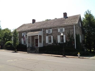
5. Hoffman House
The Hoffman House was built in 1711 and is listed on the National Landmark of Historic Places.
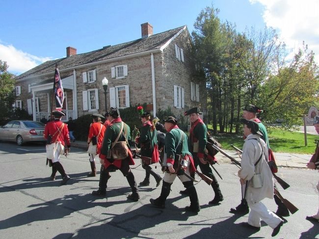
Photographed by Bill Coughlin, October 17, 2015
6. British Soldiers at the Hoffman House
The British Army march past the Hoffman House during their invasion of Kingston that ended with the burning of the town.
Credits. This page was last revised on August 5, 2021. It was originally submitted on July 13, 2012, by Bill Coughlin of Woodland Park, New Jersey. This page has been viewed 1,126 times since then and 25 times this year. Photos: 1, 2, 3, 4, 5. submitted on July 13, 2012, by Bill Coughlin of Woodland Park, New Jersey. 6. submitted on October 18, 2015, by Bill Coughlin of Woodland Park, New Jersey.
