Bushnell's Basin in Monroe County, New York — The American Northeast (Mid-Atlantic)
Bushnell's Basin
Photographed by Yugoboy, July 9, 2012
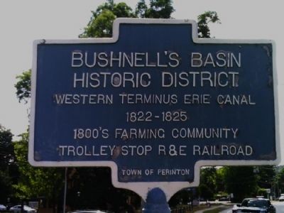
1. Bushnell's Basin Marker
Erected by Town of Perinton.
Topics and series. This historical marker is listed in these topic lists: Settlements & Settlers • Waterways & Vessels. In addition, it is included in the Erie Canal series list.
Location. This marker has been replaced by another marker nearby. It was located near 43° 3.714′ N, 77° 28.631′ W. Marker was in Bushnell's Basin, New York, in Monroe County. It was at the intersection of Marsh Road and Pittsford-Victor Rd. (New York State Route 96), on the right when traveling south on Marsh Road. Touch for map. Marker was in this post office area: Pittsford NY 14534, United States of America. Touch for directions.

Regionally, this marker was in Upstate New York, specifically in Western New York, in the Finger Lakes, and in the Rochester Metropolitan Area. It was also in the American Northeast and in the Mid-Atlantic. Globally, it was in North America, on the Great Lakes, in the Western Hemisphere, in the Western
this page online
Other nearby markers. At least 8 other markers are within 2 miles of this location, measured as the crow flies: A different marker also named Bushnell's Basin (a few steps from this marker); Richardson Tavern (within shouting distance of this marker); Historic Landmark (approx. 0.7 miles away); Harris Beach 9/11 Memorial (approx. 0.9 miles away); Seneca Trail (approx. 0.9 miles away); The Story of the Powder Mills (approx. 1.1 miles away); Erie Canal (approx. 1.1 miles away); Building the Great Embankment (approx. 1.1 miles away). Touch for a list and map of all markers in Bushnell's Basin.
More about this marker. This maker has been replaced with William G. Pomeroy Foundation marker. HMdb marker #308526

Photographed by Yugoboy, July 9, 2012
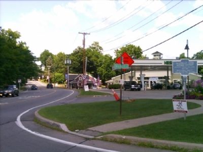
2. Bushnell's Basin Marker as seen facing East on 96
Photographed by Yugoboy, July 9, 2012
3. Bushnell's Basin Marker as seen facing West on 96
Credits. This page was last revised on August 29, 2026. It was originally submitted on July 21, 2012, by Yugoboy of Rochester, New York. This page has been viewed 1,432 times since then and 67 times this year. Photos: 1, 2, 3. submitted on July 21, 2012, by Yugoboy of Rochester, New York. • Bill Pfingsten was the editor who published this page.
