Suomenlinna in Helsinki, Uusimaa Region, Finland — Northern Europe (Scandinavia)
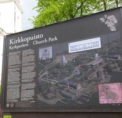
Kirkkopuisto
Kyrkparken - Church Park
— [Suomenlinna Sea Fortress] —
[Text in Finnish:] …
[Text in Swedish:] …
[Text in English:]
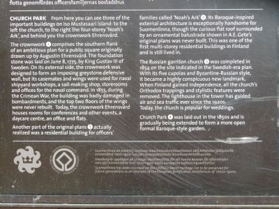
The crownwork (1) comprises the southern flank of an ambitious plan for a public square originally drawn up by Augustin Ehrensvard. The foundation stone was laid on June 8, 1775, by King Gustav III of Sweden. On its external side, the crownwork was designed to form an imposing greystone defensive wall, but its casemates and wings were used for naval shipyard workshops, a sail-making shop, storerooms and offices for the naval command. In 1855, during the Crimean War, the building was badly damaged in bombardments, and the top two floors of the wings were never rebuilt. Today, the crownwork Ehrensvard houses rooms for conferences and other events, a daycare centre, an office and flats.
Another part of the original plans (5) actually realized was a residential building for officers’ families called ‘Noah’s Ark’ (2). Its Baroque-inspired external architecture is exceptionally handsome for Suomenlinna, though the curious flat roof surrounded by an ornamental balustrade shown in A.E. Gete’s original plans was never built. This was one of the first multi-storey residential buildings in Finland and is still lived in.
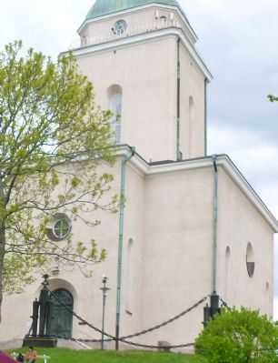
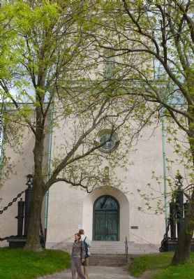
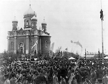
The Russian garrison church (3) was completed in 1854 on the site indicated in the Swedish-era plan. With its five cupolas and Byzantine-Russian style, it became a highly conspicuous new landmark. When Finland gained independence, all the church’s Orthodox trappings and stylistic features were removed. The lighthouse in the tower has guided air and sea traffic ever since the 1920s. Today, the church is popular for weddings.
Church Park (4) was laid out in the 1850s and is gradually being extended to form a more open formal Baroque-style garden.
[Aerial photo of Mustasaari Island with landmarks near Church Hill outlined and numbered] … Suomenlinna
Erected by UNESCO World Heritage Convention.
Topics and series. This historical marker is listed in these topic lists: Churches & Religion • Forts and Castles • Notable Places • Waterways & Vessels. In addition, it is included in the UNESCO World Heritage Sites series list. A significant historical month for this entry is June 1863.
Location. 60° 8.867′ N, 24° 59.226′ E. Marker is in Suomenlinna, Uusimaa Region, in Helsinki. Marker is on Church Park Visitors Trail just east of Helsinki Ferry Landing. Touch for map. Marker is in this post office area: Suomenlinna, Uusimaa Region 09 7097665, Finland. Touch for directions.
Other nearby markers. At least 1 other marker is within 3 kilometers of this marker, measured as the crow flies. The Senate Square (approx. 3.1 kilometers away).
Also see . . .
1. Fortress of Suomenlinna World Heritage Site. (Submitted on July 24, 2012, by Richard E. Miller of Oxon Hill, Maryland.)
2. Suomenlinna. (Submitted on July 24, 2012, by Richard E. Miller of Oxon Hill, Maryland.)
Additional keywords. "Castle Church of Finland"; UN Kirkkopuisto
Credits. This page was last revised on October 3, 2016. It was originally submitted on July 23, 2012, by Richard E. Miller of Oxon Hill, Maryland. This page has been viewed 779 times since then and 16 times this year. Photos: 1, 2, 3, 4. submitted on July 23, 2012, by Richard E. Miller of Oxon Hill, Maryland. 5. submitted on July 24, 2012, by Richard E. Miller of Oxon Hill, Maryland. 6, 7, 8, 9. submitted on July 23, 2012, by Richard E. Miller of Oxon Hill, Maryland. 10, 11. submitted on July 24, 2012, by Richard E. Miller of Oxon Hill, Maryland. • Bill Pfingsten was the editor who published this page.
