Bayfield in Bayfield County, Wisconsin — The American Midwest (Great Lakes)
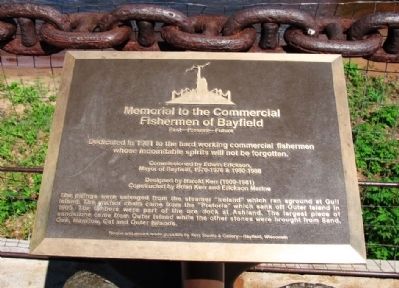
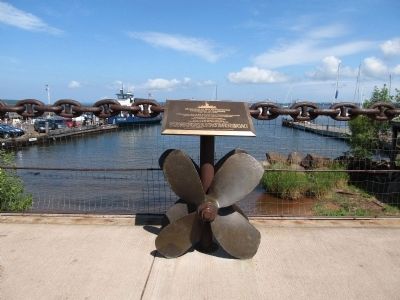
Memorial to Commercial Fishermen of Bayfield
Past—Present—Future
Photographed by Paul Fehrenbach, June 17, 2012
1. Memorial to Commercial Fishermen of Bayfield Marker
Commissioned by Edwin Erickson,
Mayor of Bayfield, 1970-1976 & 1980-1988
Designed by Harold Kerr (1909-1981)
Constructed by Brian Kerr and Erickson Marine
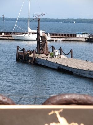
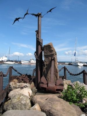
The pilings were salvaged from the steamer “Ireland” which ran aground at Gull Island. The anchor chain came from the “Pretoria” which sank off Outer Island in 1905. The timbers are part of the ore dock at Ashland. The largest piece of sandstone came from Outer Island while the other stones were brought from Sand, Oak, Manitou, Cat, and Outer Islands.
Erected 1981.
Topics. This historical marker is listed in these topic lists: Industry & Commerce • Waterways & Vessels. A significant historical year for this entry is 1981.
Location. 46° 48.687′ N, 90° 48.788′ W. Marker is in Bayfield, Wisconsin, in Bayfield County. It is on Front Street north of Rittenhouse Avenue, on the right when traveling north. Touch for map. Marker is at or near
this page online

Regionally, this marker is on Wisconsin’s North Shore. It is also in the American Midwest, in the Corn Belt, and on Lake Superior’s South Shore Region. Globally, it is in North America, in the Great North Woods, on the Great Lakes, in the Western Hemisphere, in the Western World, and in the Anglosphere. Historically, it finds itself in what was once the territory of the Mississippian Culture and also the Northwest Territory.
Other nearby markers. At least 8 other markers are within 3 miles of this marker, measured as the crow flies: Bayfield Historic Waterfront (about 300 feet away, measured in a direct line); The Booth Cooperage (about 400 feet away); Sailor’s Delight (about 700 feet away); Schooner Pretoria (approx. 0.2 miles away); A Turning Point in Place and Time (approx. 0.2 miles away); Cultural Fire Returns to Stockton Island (approx. 0.4 miles away); Mooningwaanikaaning (approx. 2½ miles away); Early Vessels (approx. 2.9 miles away). Touch for a list and map of all markers in Bayfield.
Another marker
Photographed by Paul Fehrenbach, June 17, 2012
2. Memorial to Commercial Fishermen of Bayfield Marker
Photographed by Paul Fehrenbach, June 17, 2012
3. Memorial to Commercial Fishermen of Bayfield Marker
Photographed by Paul Fehrenbach, June 17, 2012
4. Memorial to Commercial Fishermen of Bayfield
Credits. This page was last revised on June 16, 2016. It was originally submitted on July 24, 2012, by Paul Fehrenbach of Richfield, Wisconsin. This page has been viewed 931 times since then and 23 times this year. Photos: 1, 2, 3, 4. submitted on July 24, 2012, by Paul Fehrenbach of Richfield, Wisconsin. • Bernard Fisher was the editor who published this page.
