Caney in Montgomery County, Kansas — The American Midwest (Upper Plains)
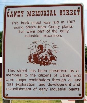
Caney Memorial Street
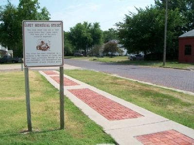
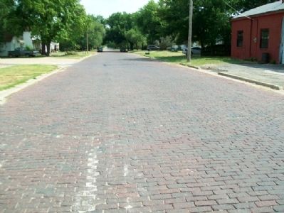
This brick street was laid in 1907 using bricks from Caney plants that were part of the early industrial expansion.
This street has been preserved as a memorial to the citizens of Caney who were major contributors through oil and gas exploration and development and establishment of early industrial plants.
Erected 2001 by Caney Valley Historical Society.
Topics. This historical marker is listed in these topic lists: Industry & Commerce • Roads & Vehicles. A significant historical year for this entry is 1907.
Location. 37° 0.678′ N, 95° 56.314′ W. Marker is in Caney, Kansas, in Montgomery County. Marker is on Wood Street near 4th Avenue, on the left when traveling south. Touch for map. Marker is in this post office area: Caney KS 67333, United States of America. Touch for directions.
Other nearby markers. At least 8 other markers are within walking distance of this marker. Caney School District No. 34 (within shouting distance of this marker); Bell's Trading Post and Village Water Well (about 300 feet away, measured in a direct line); Caney High School Stadium (approx. 0.4 miles away); World War Memorial (approx. 0.4 miles away); George H. Wark 1878 - 1974 (approx. 0.4 miles away); Black Dog Trail Campsite (approx. half a mile away); “Walking Stick” Cannon (approx. half a mile away); Caney War Memorial (approx. half a mile away). Touch for a list and map of all markers in Caney.
Also see . . . Caney Valley Historical Society. Museum website homepage (Submitted on July 25, 2012, by William Fischer, Jr. of Scranton, Pennsylvania.)
Credits. This page was last revised on January 23, 2022. It was originally submitted on July 25, 2012, by William Fischer, Jr. of Scranton, Pennsylvania. This page has been viewed 394 times since then and 14 times this year. Photos: 1, 2, 3. submitted on July 25, 2012, by William Fischer, Jr. of Scranton, Pennsylvania.


