Near Trinity Center in Trinity County, California — The American West (Pacific Coastal)
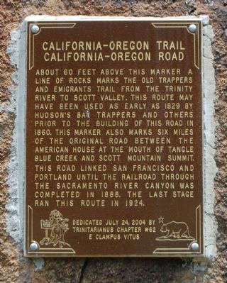
California – Oregon Trail / California – Oregon Road
Inscription.
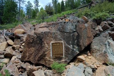
About 60 feet above this marker a line of rocks marks the old Trappers and Emigrants Trail from Trinity River to Scott Valley. This route may have been used as early as 1829 by Hudson’s Bay trappers and others prior to the building of this road in 1860. This marker also marks six miles of original road between the American House at the mouth of Tangle Blue Creek and Scott Mountain Summit. This road linked San Francisco and Portland until the railroad through the Sacramento River Canyon was completed in 1888. The last stage ran this route in 1924.
Erected 2004 by E Clampus Vitus, Trinitarianus Chapter No. 62.
Topics and series. This historical marker is listed in these topic lists: Roads & Vehicles • Settlements & Settlers. In addition, it is included in the E Clampus Vitus series list. A significant historical year for this entry is 1829.
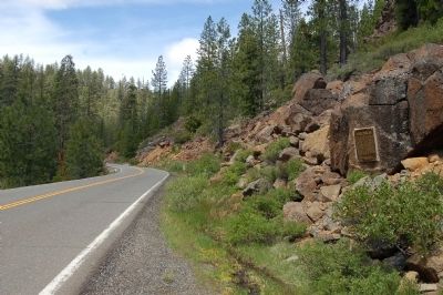
Location. 41° 15.47′ N, 122° 41.03′ W. Marker is near Trinity Center, California, in Trinity County. Marker is on Scott Mountain Road (Route 3 at milepost 83.3), on the right when traveling north. This marker is approximately 23 miles north of Trintiy Center. CAUTION!, there is no pullout near this marker. Touch for map. Marker is in this post office area: Trinity Center CA 96091, United States of America. Touch for directions.
Other nearby markers. At least 7 other markers are within 15 miles of this marker, measured as the crow flies. California – Oregon Stage Road (approx. 1.4 miles away); Church of Saints John & Paul (approx. 6.9 miles away); Hayden Hotel (approx. 7 miles away); Farrington Blacksmith Shop (approx. 7.1 miles away); Tacitus Ryland Arbuckle (approx. 9.7 miles away); Carrville (approx. 13.3 miles away); McBride Ranch (approx. 14.4 miles away).
Credits. This page was last revised on June 16, 2016. It was originally submitted on June 10, 2012, by Barry Swackhamer of Brentwood, California. This page has been viewed 651 times since then and 26 times this year. Last updated on July 27, 2012, by Barry Swackhamer of Brentwood, California. Photos: 1, 2, 3. submitted on June 10, 2012, by Barry Swackhamer of Brentwood, California. • Syd Whittle was the editor who published this page.


