Near Sharpsburg in Washington County, Maryland — The American Northeast (Mid-Atlantic)
Jackson's Command
Garland's Brigade, D.H. Hill's Division
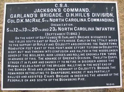
Jackson's Command,
Garland's Brigade, D.H. Hill's Division,
Col. D.K. McRae, 5th North Carolina, Commanding.
Organization.
5th, 12th, 13th, 20th, and 23d North Carolina Infantry.
(September 17, 1862.)
On the night of September 16, Garland's Brigade bivouacked in the fields south east of Roulette's House. Early on the 17th, it moved to the support of Ripley and Colquitt and, crossing the Smoketown Road a few feet east of this point, made effort to form on Colquitt's right, but was thrown into confusion and halted in the woods, under cover of boulders, rock ledges and rolling ground, a few yards in advance of this. The advance of Greene's division, Twelfth Corps, struck it in flank and caused it to retired in disorder across the Mumma Fields; a part of the brigade rallying in the west end of the Sunken Road and joining a remnant of Colquitt's Brigade, the remainder retreating to Sharpsburg, where it was partially rallied and assisted Evan's Brigade in checking the advance of the Federals on and south of the Boonsboro Pike.
Erected by Antietam Battlefield Board. (Marker Number 340.)
Topics and series. This historical marker is listed in this topic list: War, US Civil. In addition, it is included in the Antietam Campaign War Department Markers series list. A significant historical date for this entry is September 16, 1862.
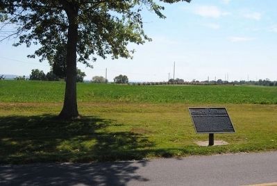
Location. 39° 28.874′ N, 77° 44.512′ W. Marker is near Sharpsburg, Maryland, in Washington County. Marker is on Cornfield Avenue, on the right when traveling west. Located at the pull off for stop three of the driving tour of Antietam Battlefield. Touch for map. Marker is in this post office area: Sharpsburg MD 21782, United States of America. Touch for directions.
Other nearby markers. At least 8 other markers are within walking distance of this marker. Greene's Division, Twelfth Army Corps (a few steps from this marker); "You Are Firing Into Our Own Men" (a few steps from this marker); The East Woods (a few steps from this marker); Longstreet's Command (within shouting distance of this marker); 13th New Jersey Infantry (within shouting distance of this marker); Sixth Army Corps (about 400 feet away, measured in a direct line); a different marker also named Longstreet's Command (about 400 feet away); First New Jersey Brigade (about 500 feet away). Touch for a list and map of all markers in Sharpsburg.
Regarding Jackson's Command. This marker is included on the East Woods Virtual Tour by Markers see the Virtual tour link below to see the markers in sequence.
Related markers. Click here for a list of markers that are related to this marker. Garland's Brigade Positions.
Also see . . .
1. Antietam Battlefield. National Park Service site. (Submitted on February 28, 2008, by Craig Swain of Leesburg, Virginia.)
2. Garland's Brigade. When Garland was killed at the battle of South Mountain, Col. D.K. McRae assumed command of the brigade. (Submitted on February 28, 2008, by Craig Swain of Leesburg, Virginia.)
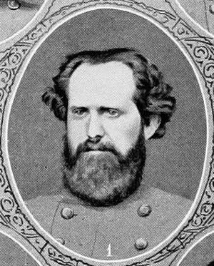
3. Col. Duncan Kirkland McRae. He had attended the University of North Carolina and William & Mary College (Va). He was U.S. District Attorney for North Carolina from 1843-50, was the US Consul-General in Paris from 1853 until 1858, and ran unsuccessfully for Governor of his state in 1858 (defeated by John W. Ellis). He was appointed Colonel of the Fifth NC Infantry by Governor Ellis when that Regiment organized on 8 May 1861. (Submitted on October 24, 2015, by Brian Scott of Anderson, South Carolina.)
Photographed By Craig Swain
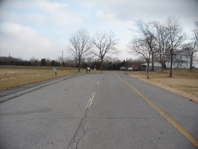
3. East End of Cornfield Avenue - Driving Tour Stop Three
At the east end of Cornfield Avenue is a pull off for stop three. Around stop three stand War Department tablet #117 (Greene's Division) and a National Park Service interpretive marker, on the left or north side of the road. On the right, or south, side of the road is War Department tablet #340 for Garland's Brigade.
Tyndall's Brigade of Green's Federal division advanced across this ground, what was then part of the East Woods.
Tyndall's Brigade of Green's Federal division advanced across this ground, what was then part of the East Woods.
Photographed By Craig Swain, February 9, 2008
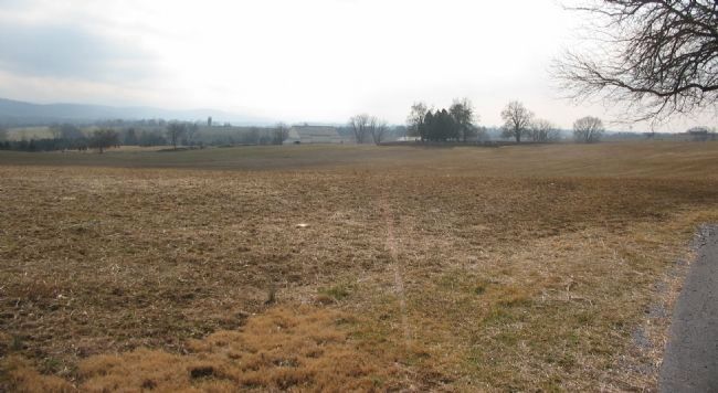
6. Garland's Brigade Position
Looking across the Mumma Farm from the Smoketown Road, at a point to the south of the marker. Originally posted near the Sunken Road, the Brigade moved up to the Mumma Farm, then across the fields along the Smoketown Road. The Brigade just reached the south corner of the East Woods before meeting heavy resistance.
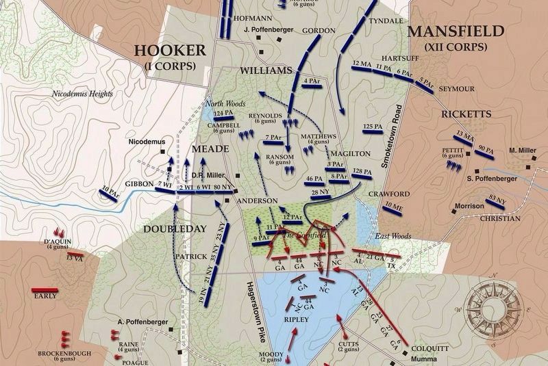
via American Battlefield Trust, unknown
7. East Woods Virtual Tour by Markers.
A collection of markers interpreting the action of during the Battle of Antietam around the East Woods.
(Submitted on March 8, 2008, by Craig Swain of Leesburg, Virginia.)
Click for more information.
(Submitted on March 8, 2008, by Craig Swain of Leesburg, Virginia.)
Click for more information.
Credits. This page was last revised on April 4, 2022. It was originally submitted on February 28, 2008, by Craig Swain of Leesburg, Virginia. This page has been viewed 884 times since then and 20 times this year. Photos: 1. submitted on February 28, 2008, by Craig Swain of Leesburg, Virginia. 2. submitted on October 24, 2015, by Brian Scott of Anderson, South Carolina. 3. submitted on February 28, 2008, by Craig Swain of Leesburg, Virginia. 4, 5. submitted on October 24, 2015, by Brian Scott of Anderson, South Carolina. 6. submitted on February 28, 2008, by Craig Swain of Leesburg, Virginia. 7. submitted on April 4, 2022, by Larry Gertner of New York, New York.
