Gerolzhofen in Schweinfurt, Bavaria, Germany — Central Europe
Spital Gate
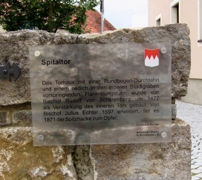
Spitaltor
[Marker text in German:]
Geschichte für alle - historischer Verein in Gerolzhofen, e.V.
Dr. Ottmar Wolf – Kulturstiftung
[Marker text translated into English, more or less:]
History for All - the Gerolzhofen Historical Society
Dr. Ottmar Wolf Cultural Foundation
Erected by The Gerolzhofen Historical Society and the Dr. Ottmar Wolf Cultural Foundation.
Topics. This historical marker is listed in these topic lists: Forts and Castles • Roads & Vehicles. A significant historical year for this entry is 1472.
Location. 49° 53.999′ N, 10° 21.039′ E. Marker is in Gerolzhofen, Bayern (Bavaria), in Schweinfurt. Marker is at the intersection of Spitalstrasse and Grabenstrasse, on the left on Spitalstrasse. Touch for map. Marker is in this post office area: Gerolzhofen BY 97447, Germany. Touch for directions.
Other nearby markers. At least 8 other markers are within walking distance of this marker. The Beadle’s Tower (within shouting distance of this marker); The Former Adminstrative Building (within shouting distance of this marker); Bürgerspital / Municipal Hospital (within shouting distance of this marker); Spottfratze, ca. 1450 (about 90 meters away, measured in a direct line); "Gerolzhöfer Frauenaufstand" / The Gerolzhofen "Womens' Revolt" (about 120 meters away); Fachwerkhaus Teutsch / Teutsch Building (about 120 meters away); Altes Rathaus / The Old City Hall (about 120 meters away); The Decline of the Jewish Community of Gerolzhofen from January 30, 1933 (about 120 meters away). Touch for a list and map of all markers in Gerolzhofen.
Photographed By Andrew Ruppenstein, July 18, 2012
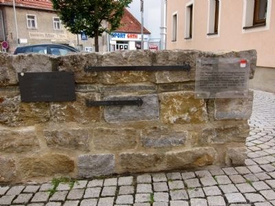
2. Spital Gate Marker - slightly wider view
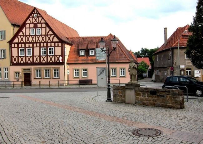
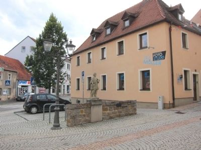
The Spital Gate marker is mounted on a low wall in a small plaza at the foot of Spitalstrasse. Visible to the left of the marker are examples of the local units of measurement, the "Schuh" (shoe) - 29.6 cm or 11.65 inches, and the "Elle" (ulna or forearm) - 59.2 cm or 23.2 inches. The plaque to the immediate left of these lists the local units of measurement and their metric equivalents.
Photographed By Andrew Ruppenstein, July 18, 2012
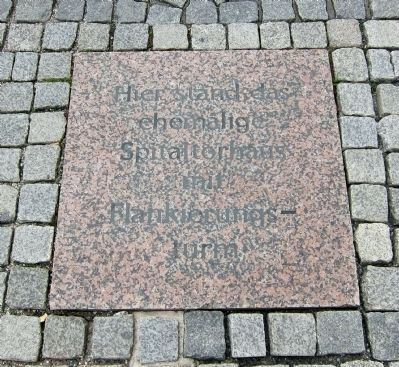
5. Spital Gate Marker - Paving insets
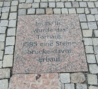
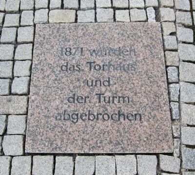
Just a few steps away from the marker is a set of 4 paving stones set into the roadway, with each paver providing additional information. This one reads, Hier stand das ehemalige Spitaltorhaus mit Flankierungsturm, - Here stood the former Spital Gatehouse with flanking tower.
Photographed By Andrew Ruppenstein, July 18, 2012
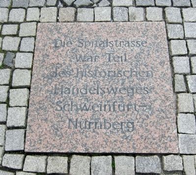
6. Spital Gate Marker - Paving Inset No. 2
Die Spitalstrasse war Teil des historischen Handelsweges Schweinfurt - Nurnberg - The Spital Street was a part of the historic trade route between Schweinfurt and Nuremberg. (Schweinfurt was a relatively minor city roughly 20 km NNW, while Nuremberg was a major commercial center roughly 80 km to the SE.)
Photographed By Andrew Ruppenstein, July 18, 2012
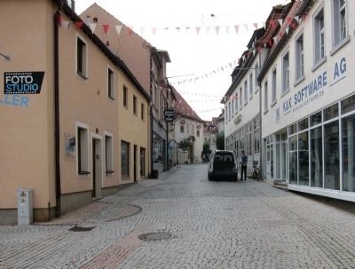
9. View from the Spital Gate Marker - looking north up Spitalstrasse
Here in the view looking up Spitalstrasse toward the Spital location are visible two of the related paving stones. The Spital itself is located on the left side of the street, roughly where in the picture the street takes a bend to right.
Photographed By Franz Leinecker, circa 1842/1847
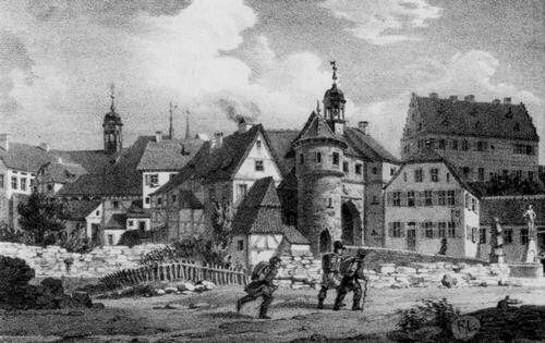
10. Spital Gate Marker
This lithograph of the Spital Gate and Tower first appeared in the Würzburger Abendblattes sometime in the 1842-1847 period. The original is kept in the Mainfränkisches Museum. The marker site is easily visible here, approximately by the two statues in the right of the picture. (Click on picture to enlarge.)
Credits. This page was last revised on January 7, 2024. It was originally submitted on July 29, 2012, by Andrew Ruppenstein of Lamorinda, California. This page has been viewed 556 times since then and 10 times this year. Photos: 1, 2, 3, 4, 5, 6, 7, 8, 9, 10. submitted on July 29, 2012, by Andrew Ruppenstein of Lamorinda, California. • Syd Whittle was the editor who published this page.
