Near Trinity Center in Trinity County, California — The American West (Pacific Coastal)
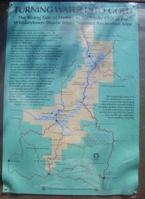
Turning Water into Gold

Photographed By Barry Swackhamer, July 19, 2012
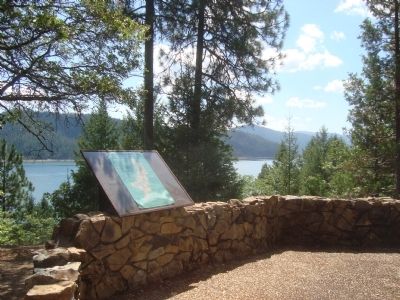
1. Turning Water into Gold Marker
This map is an historical representation of the “Trinity Valley” prior to the construction of Trinity and Lewiston Dams. Most of the features shown were razed or relocated. For current information about the Trinity Unit of the Whiskeytown-Shasta-Trintiy National Recreation Area refer to the Trinity Unit Map available at the nearest U.S. Forest Service Ranger Station.
[Click on image to enlarge]
By 1956 the Gold Rush was only an echo along the river now covered by Trinity and Lewiston Lakes. The abandoned remnants of fevered mining activity sat broken and rusting on the landscape... A reminder of the glory days when men and women sought their fortunes in Trinity gold.
Wintu culture was all but destroyed, the miners moved on. Ranchers, farmers, loggers, owners of fledgling resorts, and merchants stayed on. Each group of people, in its own way, was fiercely dependent upon water so abundant in the Trinity River and its tributaries. Indian, white or chinese, their communities and their work were never far from it.
With the completion of the dam in 1961, the face of this country was changed forever. Generations of human effort were lost beneath water hundreds of feet deep... a way of life in the “Trinity Valley” had died... A new one was born.
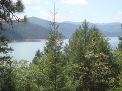
Today we water ski, houseboat, fish and swim in water that overlays a rich history. Somewhere below, in ages past, a stagecoach brought the first teacher to the school in Minersville... Cattle grazed contentedly on the verdant paturage of the Scott Ranch... A Wintu indian woman gathered acorns beneath the blue oaks of Hays Gulch... Miners toiled over rich diggings... San Francisco tourists fished for prize salmon at Cedar Stock Resort on Stuart’s Fork of the Trinity River.
This National Recreation Area was established by Congress in 1965 to accommodate the growing national need for expanded outdoor recreation facilities. Water impounded by Trinity and Lewiston Dams has become the Gold of the 21st Century... In a way the early settlers here never would have imagined.
Erected by United States Department of Agriculture – Forest Service.
Topics. This historical marker is listed in these topic lists: Roads & Vehicles • Settlements & Settlers • Waterways & Vessels. A significant historical year for this entry is 1956.
Location. 41° 1.115′ N, 122° 41.548′ W. Marker is near Trinity Center, California, in Trinity County. Marker is at the intersection of Highway 3 (California Route 3 at milepost 64.2), on the right when traveling north on Highway 3. This marker is located at Stop #10 on the Trinity Heritage Scenic Byway Self-Guided Auto Tour. Touch for map. Marker is in this post office area: Trinity Center CA 96091, United States of America. Touch for directions.
Other nearby markers. At least 5 other markers are within 9 miles of this marker, measured as the crow flies. “Jim Swett Field” (approx. 2.2 miles away); Bucket Line Dredges (approx. 2.4 miles away); Trinity Centre Then – Trinity Center Now. (approx. 2˝ miles away); Carrville (approx. 3.3 miles away); The Bowerman Barn (approx. 9.1 miles away).
Credits. This page was last revised on June 16, 2016. It was originally submitted on July 30, 2012, by Barry Swackhamer of Brentwood, California. This page has been viewed 475 times since then and 14 times this year. Photos: 1, 2, 3. submitted on July 30, 2012, by Barry Swackhamer of Brentwood, California. • Syd Whittle was the editor who published this page.

