Henrietta in Monroe County, New York — The American Northeast (Mid-Atlantic)
The East Henrietta Village
Photographed by Yugoboy, July 29, 2012
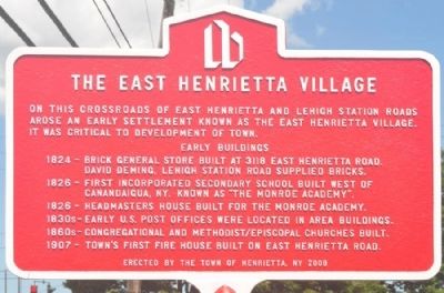
1. The East Henrietta Village Marker
Early Buildings
1824 - Brick general store built at 3118 East Henrietta Road. David Deming. Lehigh Station Road supplied bricks.
1826 - First incorporated secondary school built west of Canandaigua, NY. Known as "The Monroe Academy".
1826 - Headmasters House built for the Monroe Academy.
1830s - Early U.S. Post Offices were located in area buildings.
1860s - Congregational/Methodist churches built.
1907 - Town's first firehouse built on East Henrietta Road.
Erected 2006 by Town of Henrietta, NY.
Topics. This historical marker is listed in these topic lists: Roads & Vehicles • Settlements & Settlers. A significant historical year for this entry is 1824.
Location. 43° 3.537′ N, 77° 36.748′ W. Marker is in Henrietta, New York, in Monroe County. It is at the intersection of East Henrietta Road (New York State Route 15A) and Lehigh Station Road, on the right when traveling north on East Henrietta Road. While not technically at the crossroads,
this page online

Regionally, this marker is in Upstate New York, specifically in Western New York, in the Finger Lakes, and in the Rochester Metropolitan Area. It is also in the American Northeast and in the Mid-Atlantic. Globally, it is in North America, on the Great Lakes, in the Western Hemisphere, in the Western World, and in the Anglosphere. Historically, it finds itself in what was once the Haudenosaunee (Iroquois) Confederacy, New Netherland, and one of the original Thirteen Colonies.
Other nearby markers. At least 8 other markers are within 4 miles of this marker, measured as the crow flies: The Headmaster's House and the Monroe Academy (about 500 feet away, measured in a direct line); Andrew Short House (approx. 0.9 miles away); Born in Log House (approx. 0.9 miles away); Richardson Farm (approx. 1.3 miles away); District No. 6 (approx. 1.7 miles away); West Henrietta Farm (approx. 2.7 miles away); The West Henrietta Village (approx. 2.8 miles

Photographed by Mira Earls, May 30, 2026
2. The East Henrietta Village Marker
This is the condition of this marker as of 27 May 2026.
Photographed by Yugoboy, July 29, 2012
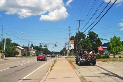
3. The East Henrietta Village Marker as seen facing north on 15A
Photographed by Yugoboy, July 29, 2012
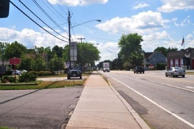
4. The East Henrietta Village Marker as seen facing south on 15A

Photographed by Mira Earls, May 30, 2026
5. The East Henrietta Village Marker
I had to move some branches to get a decent photo.

Photographed by Mira Earls, 11
6. The East Henrietta Village Marker
This was taken 27 May 2026. I had to move several branches to get a usable photo!
Credits. This page was last revised on July 9, 2026. It was originally submitted on August 6, 2012, by Yugoboy of Rochester, New York. This page has been viewed 710 times since then and 37 times this year. Photos: 1. submitted on August 6, 2012, by Yugoboy of Rochester, New York. 2. submitted on June 1, 2026, by Mira Earls of Cortland, New York. 3, 4. submitted on August 6, 2012, by Yugoboy of Rochester, New York. 5, 6. submitted on June 1, 2026, by Mira Earls of Cortland, New York. • Bill Pfingsten was the editor who published this page.
