New Bedford in Bristol County, Massachusetts — The American Northeast (New England)
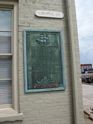
The Dartmouth
Near this spot in 1767 the first ship built in New Bedford was launched.
Francis Rotch, Owner
She was one of the vessels boarded by the Boston Tea Party in 1773
Erected 1924 by The New Bedford Chapter of he Sons of The American Revolution.
Topics and series. This historical marker is listed in these topic lists: Colonial Era • War, US Revolutionary • Waterways & Vessels. In addition, it is included in the Sons of the American Revolution (SAR) series list. A significant historical year for this entry is 1767.
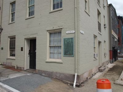
Location. 41° 38.116′ N, 70° 55.316′ W. Marker is in New Bedford, Massachusetts, in Bristol County. Marker is at the intersection of Centre Street and Front Street, on the left when traveling east on Centre Street. Touch for map. Marker is in this post office area: New Bedford MA 02740, United States of America. Touch for directions.
Other nearby markers. At least 8 other markers are within walking distance of this marker. From Whales to Flatfish and Scallops (within shouting distance of this marker); Commonwealth of Toil (within shouting distance of this marker); Centre Street (about 300 feet away, measured in a direct line); From Whales to Bales (about 300 feet away); Working Waterfront (about 300 feet away); Whaling Capital (about 300 feet away); Double Bank (about 300 feet away); Viking (about 400 feet away). Touch for a list and map of all markers in New Bedford.
Credits. This page was last revised on September 30, 2020. It was originally submitted on August 8, 2012, by Bryan Simmons of Attleboro, Massachusetts. This page has been viewed 613 times since then and 25 times this year. Photos: 1, 2. submitted on August 8, 2012, by Bryan Simmons of Attleboro, Massachusetts. • Bill Pfingsten was the editor who published this page.

