Tree Park in Chattanooga in Hamilton County, Tennessee — The American South (East South Central)
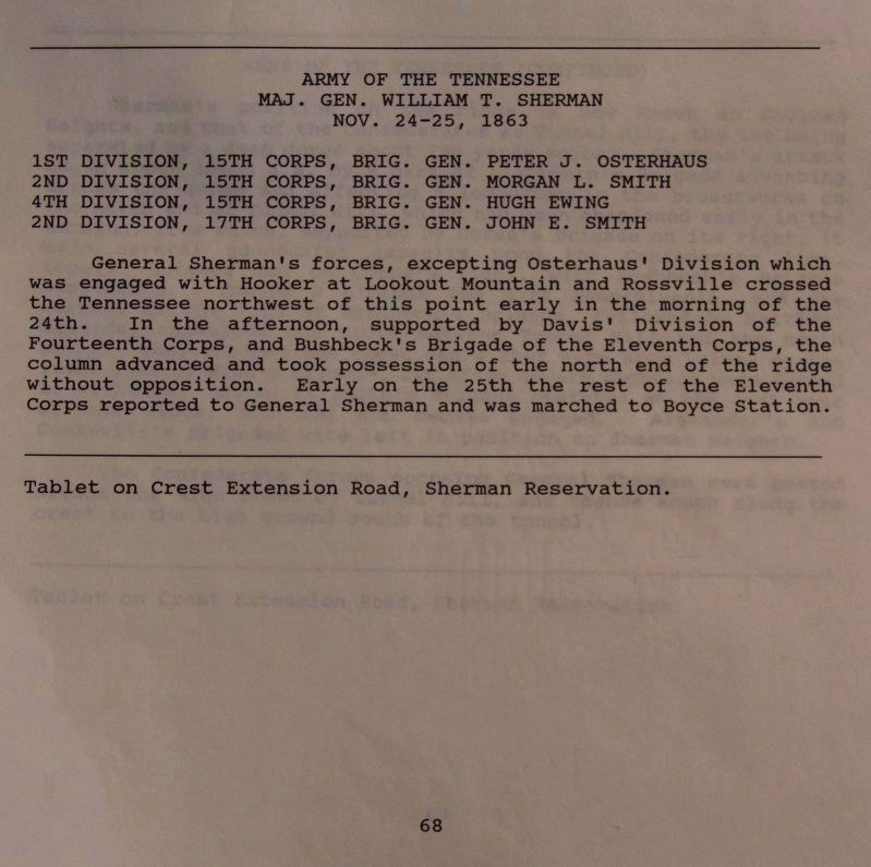
Army of the Tennessee
Maj. Gen. William T. Sherman.
— November 24 - 25, 1863. —
Inscription.
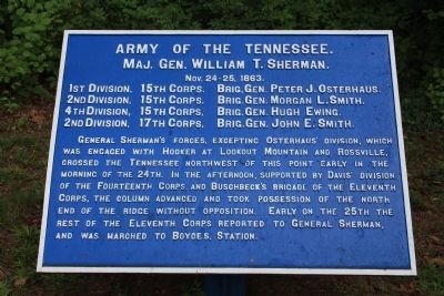
[Text on the 1st Tablet]:
Maj. Gen. William T. Sherman.
November 24 - 25, 1863.
1st Division, 15th Corps. Brig. Gen. Peter J. Osterhaus.
2nd Division, 15th Corps. Brig. Gen. Morgan L. Smith.
4th Division, 15th Corps. Brig. Gen. Hugh Ewing.
2nd Division, 17th Corps. Brig. Gen. John E. Smith.
General Sherman's forces, excepting Osterhaus' Division, which engaged with Hooker at Lookout Mountain and Rossville, crossed the Tennessee northwest of this point early in the morning of the 24th. In the afternoon, supported by Davis' Division of the Fourteenth Corps. and Buschbeck's Brigade of the Eleventh Corps. the column advanced and took possession of the north end of the ridge without opposition. Early on the 25th the rest of the Eleventh Corps reported to General Sherman, and was marched to Boyces Station.
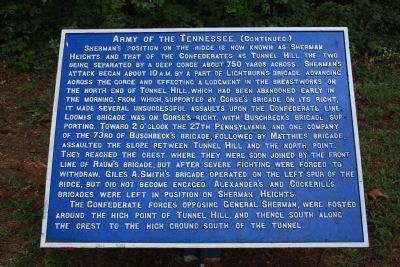
[Text on the 2nd Tablet]:
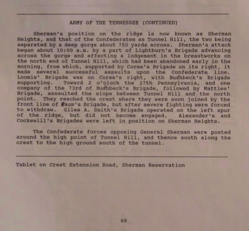
The Confederate forces opposing General Sherman, were posted around the high point of Tunnel Hill, and thence south along the crest to the high ground south of the tunnel.
Erected 1890 by the Chickamauga-Chattanooga National Battlefield Commission. (Marker Number MT-68 & 69.)
Topics and series. This historical marker is listed in this topic list: War, US Civil. In addition, it is included in the Chickamauga and Chattanooga National Military Park, Sherman Reservation
, and the Chickamauga and Chattanooga National Military Park: November 25, 1863 series lists. A significant historical year for this entry is 1863.
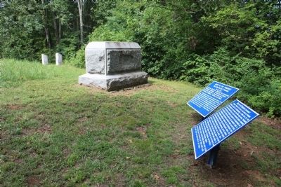
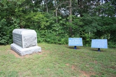
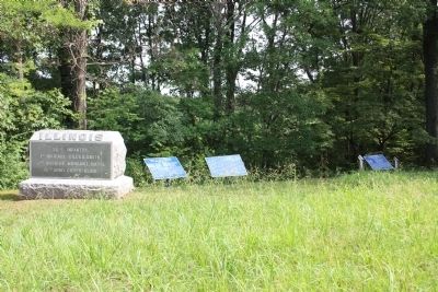
Location. 35° 4.287′ N, 85° 14.357′ W. Marker is in Chattanooga, Tennessee, in Hamilton County. It is in Tree Park. Marker can be reached from North Crest Road near Lightfoot Mill Road. This historic marker is located in the Sherman Reservation, up on the hill called the "Sherman Heights," and is situated northwest of the Iowa monument, near the top of the hill. Touch for map. Marker is in this post office area: Chattanooga TN 37404, United States of America. Touch for directions.
Other nearby markers. At least 8 other markers are within walking distance of this marker. 55th Illinois Infantry (here, next to this marker); 53rd Ohio Infantry (a few steps from this marker); 70th Ohio Infantry (a few steps from this marker); 6th U.S. Missouri Infantry (a few steps from this marker); Cockerill's Brigade (a few steps from this marker); 8th U.S. Missouri Infantry (a few steps from this marker); Earthworks (a few steps from this marker); Ewing's Division (within shouting distance of this marker). Touch for a list and map of all markers in Chattanooga.
More about this marker. Because of its location in the Sherman Reservation it cannot be reached by car and can only be reached by foot. I would suggest parking your car in the
provided parking area on Lightfoot Mill Road and then walking north on North Crest Road. You will reach a spot on this road where there is a locked gate barring further vehicle traffic on the road, but not foot traffic. Continue to walk all the way to the end of North Crest Road. Once there you will see a pathway that goes from the end of the road to the center of the gorge that separates "Tunnel Hill" to your south and "Sherman Heights" to your north. This historic marker is to the north on "Sherman Heights."
Regarding Army of the Tennessee. While this tablet identifies both the location and role played during the military action of the Army of Tennessee, as well as listing the divisional units that make up this army, none of the listed divisions, except for Osterhaus' Division, have individual markers and/or tablets for the park visitor to view (according to the NPS staff, none were ever made). So the brigades for the Morgan L. Smith Division and the John E. Smith Division have been listed on the "related marker list," along with a D/L Marker for Ewing's Division.
In response to a request for location information on these particular division tablets, the staff of the NPS stated, "As with John E. Smith's Division ...., there does not appear as if there ever were division cast iron tablets for Morgan L. Smith's or Hugh Ewing's
divisions."
Related markers. Click here for a list of markers that are related to this marker. Use this link to see the related Division tablets for the Army of the Tennessee.
Also see . . .
1. Army of the Tennessee. This is a link to information provided by Wikipedia, the free encyclopedia. (Submitted on August 9, 2012, by Dale K. Benington of Toledo, Ohio.)
2. Army of the Tennessee. (Submitted on August 9, 2012, by Dale K. Benington of Toledo, Ohio.)
Credits. This page was last revised on February 7, 2023. It was originally submitted on August 9, 2012, by Dale K. Benington of Toledo, Ohio. This page has been viewed 689 times since then and 15 times this year. Photos: 1, 2, 3, 4, 5. submitted on August 9, 2012, by Dale K. Benington of Toledo, Ohio. 6, 7. submitted on September 29, 2017, by Dale K. Benington of Toledo, Ohio.
