East Bank in Terre Haute in Vigo County, Indiana — The American Midwest (Great Lakes)
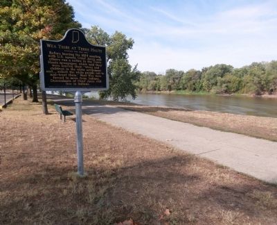
Wea Tribe at Terre Haute
Photographed by Courtesy:: Marilyn S. Wolf, August 12, 2012
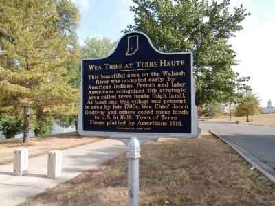
1. Side "One" - - Wea Tribe at Terre Haute Marker
Side One
This bountiful area on the Wabash River was occupied early by American Indians. French and later Americans recognized this strategic area called terre haute (high land). At least one Wea village was present in area by late 1700s. Wea Chief Jacco Godfroy and others ceded these lands to U.S. in 1809. Town of Terre Haute platted by Americans 1816.
Side Two
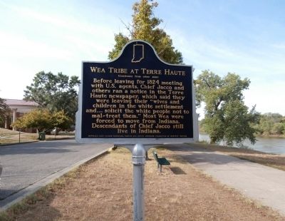
Before leaving for 1824 meeting with U.S. agents, Chief Jacco and others ran a notice in the Terre Haute newspaper, which said they were leaving their "wives and children in the white settlement and . . . solicit the white people not to mal-treat them." Most Wea were forced to move from Indiana. Descendants of Chief Jacco still live in Indiana.
Erected 2004 by Indiana Historical Bureau and Native American Foundation of Western Indiana. (Marker Number 84.2004.1.)
Topics and series. This historical marker is listed in this topic list: Indigenous Peoples and Communities. In addition, it is included in the Indiana Historical Bureau Markers series list. A significant historical year for this entry is 1809.
Location. 39° 27.616′ N, 87° 25.124′ W. Marker is
this page online

Regionally, this marker is in Central Indiana and in the Wabash Valley. It is also in the American Midwest and in the Corn Belt. Globally, it is in North America, the Western Hemisphere, the Western World, and the Anglosphere. Historically, it finds itself in what was once the Viceroyalty of New France, the territory of the Mississippian Culture, and the Northwest Territory.
Other nearby markers. At least 8 other markers are within walking distance of this marker: Birthplace of Paul Dresser (approx. ¼ mile away); Lynching in America / Facing Injustice (approx. 0.4 miles away); Vietnam War Memorial - - Vigo County Indiana (approx. 0.4 miles away); Claude L. Herbert (approx. 0.4 miles away); Korean War Memorial - - Vigo County Indiana (approx. 0.4 miles away); Medal of Honor Recipient (approx. 0.4 miles away); Operation Iraqi Freedom - War Memorial
Photographed by Courtesy:: Marilyn S. Wolf, August 12, 2012
2. Side "Two" - - Wea Tribe at Terre Haute Marker
More about this marker. Take along with you a picnic lunch and or fishing gear. This is a nice place to relax.
Also see . . .
1. Wea Indian Tribe of Indiana. Website homepage (Submitted on August 13, 2012, by Al Wolf of Veedersburg, Indiana.)
2. Photos of Dedication. Indiana Historical Bureau website entry (Submitted on January 22, 2013, by Al Wolf of Veedersburg, Indiana.)
Photographed by Courtesy:: Marilyn S. Wolf, August 12, 2012
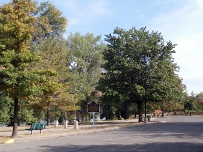
3. Wide View - Side "One" - - Wea Tribe at Terre Haute Marker
Photographed by Courtesy:: Marilyn S. Wolf, August 12, 2012
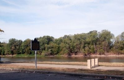
4. Wide View - Side "Two" - - Wea Tribe at Terre Haute Marker
Photographed by Courtesy:: Marilyn S. Wolf, August 12, 2012
5. Other View - - Wea Tribe at Terre Haute Marker
Credits. This page was last revised on November 27, 2021. It was originally submitted on August 13, 2012, by Al Wolf of Veedersburg, Indiana. This page has been viewed 1,946 times since then and 84 times this year. Photos: 1, 2, 3, 4, 5. submitted on August 13, 2012, by Al Wolf of Veedersburg, Indiana.
