Fremont in Dodge County, Nebraska — The American Midwest (Upper Plains)
Overland Emigrant Trails

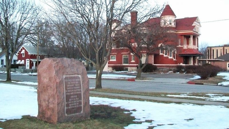
Photographed by William Fischer, Jr., February 17, 2012
1. Overland Emigrant Trails Marker
Overland Emigrant Trails
through Fremont to
Oregon, California, Utah
and Colorado
Erected Setp. 23, 1912
Erected 1912 by Lewis-Clark Chapter, Daughters of the American Revolution.
Topics and series. This historical marker is listed in this topic list: Roads & Vehicles. In addition, it is included in the Daughters of the American Revolution (DAR) series list. A significant historical year for this entry is 1912.
Location. Marker has been permanently removed. It was located near 41° 26.15′ N, 96° 29.689′ W. Marker was in Fremont, Nebraska, in Dodge County. It was at the intersection of Military Avenue and D Street, on the left when traveling east on Military Avenue. Touch for map. Marker was in this post office area: Fremont NE 68025, United States of America.
We have been informed that this marker is no longer there and will not be replaced. This page is an archival view of what was.
Regionally, this marker was in Eastern Nebraska and in Greater Omaha. It was also in the American Midwest, in the Corn Belt, and on the prairies. Globally, it was in North America, the Western Hemisphere, the Western World, and the Anglosphere. Historically, it found itself in what was once the Louisiana Purchase.

Other nearby markers. At least 8 other markers are within 4 miles of this location, measured as the crow flies: Union Depot (approx. 0.2 miles away); Fremont's First City-Owned Parking Lot (approx. 0.2 miles away); Hotel Pathfinder (approx. 0.2 miles away); Fremont, Nebraska (approx. 0.2 miles away); Dodge County Veterans Memorial (approx. 0.2 miles away); Mormon Pioneer Trail (approx. ¼ mile away); Pawnee Villages (approx. 2.6 miles away); The Great Platte River Route West (approx. 3.9 miles away). Touch for a list and map of all markers in Fremont.
Also see . . .
1. Oregon National Historic Trail.
this page online
2. California National Historic Trail. (Submitted on August 19, 2012, by William Fischer, Jr. of Reynoldsburg, Ohio.)
3. Mormon Pioneer National Historic Trail. (Submitted on August 19, 2012, by William Fischer, Jr. of Reynoldsburg, Ohio.)
Additional commentary.
1. Monument removed sometime after July, 2012.
Looking at the Google Street View photos of the area, the last photo showing the monument was July, 2012.
— Submitted May 2, 2024, by Mark Hilton of Montgomery, Alabama.
Photographed by William Fischer, Jr., February 17, 2012
2. Overland Emigrant Trails Marker
Credits. This page was last revised on November 6, 2025. It was originally submitted on August 19, 2012, by William Fischer, Jr. of Reynoldsburg, Ohio. This page has been viewed 973 times since then and 53 times this year. Photos: 1, 2. submitted on November 6, 2025, by William Fischer, Jr. of Reynoldsburg, Ohio.
