Fremont in Dodge County, Nebraska — The American Midwest (Upper Plains)
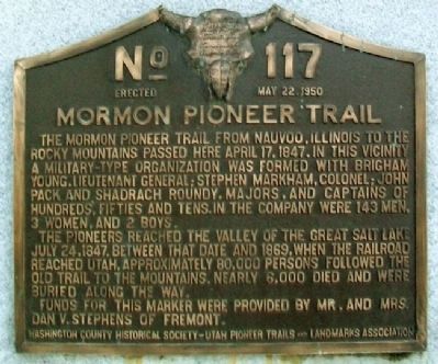
Mormon Pioneer Trail
The pioneers reached the valley of the Great Salt Lake July 24, 1847. Between that date and 1869, when the railroad reached Utah, approximately 80,000 persons followed the old trail to the mountains. Nearly 6,000 died and were buried along the way.
Funds for this marker were provided by Mr. and Mrs. Dan V. Stephens of Fremont.
Erected May 22, 1950
Erected 1950 by Washington County Historical Society – Utah Pioneer Trails and Landmarks Association. (Marker Number 117.)
Topics and series. This historical marker is listed in these topic lists: Churches & Religion • Exploration • Roads & Vehicles • Settlements & Settlers. In addition, it is included in the Mormon Pioneer Trail, and the Utah Pioneer Trails and Landmarks Association series lists. A significant historical month for this entry is April 1779.
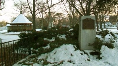
Location. 41° 26.116′ N, 96° 29.415′ W. Marker is in Fremont, Nebraska, in Dodge County. Marker is on Military Avenue, on the right when traveling east. Marker is along the northern boundary of Barnard Park, between Clarkson Street and Irving Avenue. Touch for map. Marker is in this post office area: Fremont NE 68025, United States of America. Touch for directions.
Other nearby markers. At least 4 other markers are within walking distance of this marker. Union Depot (approx. 0.3 miles away); Fremont's First City-Owned Parking Lot (approx. 0.4 miles away); Fremont, Nebraska (approx. 0.4 miles away); Dodge County Veterans Memorial (approx. 0.4 miles away).
Also see . . . Mormon Pioneer National Historic Trail. (Submitted on August 19, 2012, by William Fischer, Jr. of Scranton, Pennsylvania.)
Credits. This page was last revised on November 21, 2020. It was originally submitted on August 19, 2012, by William Fischer, Jr. of Scranton, Pennsylvania. This page has been viewed 928 times since then and 39 times this year. Photos: 1, 2. submitted on August 19, 2012, by William Fischer, Jr. of Scranton, Pennsylvania.

