Near Jonesville in Union County, South Carolina — The American South (South Atlantic)
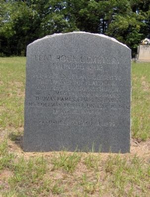
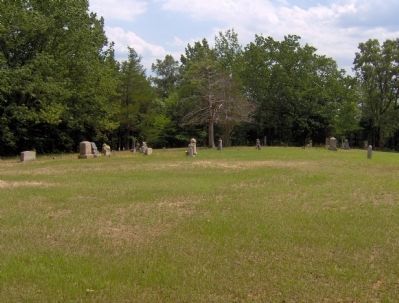
Flat Rock Cemetery
Founded 1802
Recorded December 3, 1839
Topics. This historical marker is listed in this topic list: Cemeteries & Burial Sites. A significant historical month for this entry is May 1996.
Location. 34° 51.709′ N, 81° 35.68′ W. Marker is near Jonesville, South Carolina, in Union County. Marker is at the intersection of Eisontown Road and Peter Hawk Creek Road on Eisontown Road. Touch for map. Marker is in this post office area: Jonesville SC 29353, United States of America. Touch for directions.
Other nearby markers. At least 8 other markers are within 6 miles of this marker, measured as the crow flies. Balloon Landing, 1861 (approx. 2.1 miles away); Kelton (approx. 2.1 miles away); Professor Lowe Balloon Landing Site (approx. 2.1 miles away); Steen Family Cemetery (approx. 5 miles away); Jonesville Confederate Monument (approx. 5.1 miles away); Jonesville Veterans Monument (approx. 5.3 miles away); Littlejohn Family Reunion (approx. 5.6 miles away); Mulberry Chapel Methodist Church (approx. 5.8 miles away). Touch for a list and map of all markers in Jonesville.
Credits. This page was last revised on June 16, 2016. It was originally submitted on August 19, 2012, by Charles R. Robbins, Jr. of Rock Hill, South Carolina. This page has been viewed 816 times since then and 38 times this year. Photos: 1, 2, 3, 4. submitted on August 19, 2012, by Charles R. Robbins, Jr. of Rock Hill, South Carolina. • Craig Swain was the editor who published this page.


