Lexington, Virginia — The American South (Mid-Atlantic)
Jordan’s Point
“A day I will never forget…” Margaret Junkin Preston diary, June 12, 1864
Photographed by Bill Coughlin, August 20, 2012
1. Jordan’s Point Marker
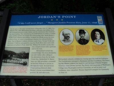
On this spot, in the early morning hours of Saturday, June 11, 1864, Confederate General John McCausland and about 1,500 gray-clad soldiers lined the riverbank between a cedar thicket and the warehouses that cluttered the canal landing. They stretched up the bluff behind you where a Confederate artillery section was located. By mid-morning, General David Hunter’s 18,000 Union infantry and artillery occupied the hillside across the river in front of you, en route to Lynchburg to destroy the railroad facilities there. Two of Hunter’s infantry divisions under Generals George Crook and Jeremiah C. Sullivan attempted to cross the North River here and a mile upstream at Leyburn’s Ford, while Geneneral William W. Averill’s cavalry division crossed several miles upstream and to the west.
McCausland torched the covered bridge (the stone abutments are still visible) after calling in his skirmishers from the far bank. Union Gen. Rutherford B. Hayes, later our nineteenth president, commanded the first Federals to arrive on the opposite bank. Several hours of skirmishing followed while Hunter’s forces consolidated their position. By
this page online
Erected by Virginia Civil War Trails.
Topics and series. This historical marker is listed in this topic list: War, US Civil. In addition, it is included in the Former U.S. Presidents: #19 Rutherford B. Hayes, and the Virginia Civil War Trails series lists. A significant historical date for this entry is June 11, 1913.
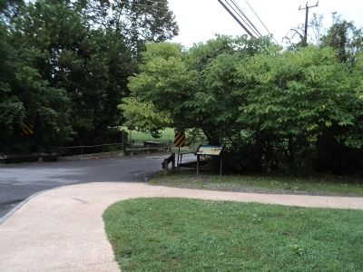
Location. This marker has been replaced by another marker nearby. It was located near 37° 47.539′ N, 79° 25.766′ W. Marker was in Lexington, Virginia. It was at the intersection of Moses Mill Road and Saunders Drive (Woods Creek Service Road), on the right when traveling north on Moses Mill Road. Marker is located in Jordan’s Point Park. Touch for map. Marker was at or near this postal address:

Photographed by Bradley Owen, August 12, 2024
2. Jordan’s Point Marker
Portions of the marker have become significantly unreadable.

Regionally, this marker was in Virginia’s Shenandoah Valley. It was also in the American South and specifically in the Upper South. Globally, it was in North America, the Western Hemisphere, the Western World, and the Anglosphere. Historically, it found itself in what was once the territory of the Mississippian Culture, one of the original Thirteen Colonies, one of the Confederate States of America, and the Antebellum South.
Other nearby markers. At least 8 other markers are within walking distance of this location: A different marker also named Jordan's Point (here, next to this marker); Mills, Forges and Foundries... (here, next to this marker); Iron Rails, Steam Locomotives, 90 years (a few steps from this marker); The Rise and Fall of an American Waterfront (a few steps from this marker); Entrepreneurs, Tradesmen and Laborers (a few steps from this marker); Road, River and Rail: (a few steps from this marker); Wharf, Work and Worship (within shouting distance of this marker); First it was cotton, then it was barrels, then it was grain...

Photographed by Bill Coughlin, August 20, 2012
3. Jordan’s Point Marker
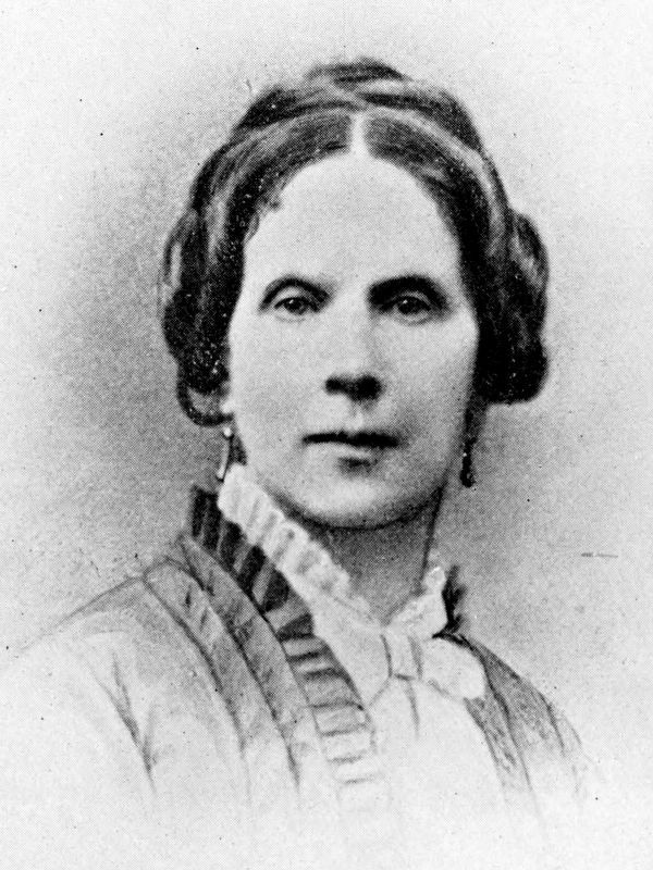
More about this marker. Three portraits appear at the top right of the marker. The first one, of Gen. McCausland, has a caption of “Gen. John McCausland (Virginia Military Institute class of 1857), burned Chambersburg, Pa., on July 30, 1864, in retaliation for the damage Hunter inflicted.” Next to this is Gen. Hunter with the caption “Gen. David Hunter (West Point class of 1822) took command of the Union forces in the Shenandoah Valley only three weeks before arriving in Lexington. He later sat on the military commission that tried the Lincoln assassination conspirators.” The last is of Margaret Preston and includes the caption “Margaret Junkin Preston, daughter of Washington College’s president, wife of John Preston (a founder of VMI), and sister-in-law of Stonewall Jackson.”
A photography of a canal boat appears at the lower left of the marker. It has a caption of “Jordan’s Point, late 1865, from opposite bank. Stono, John Jordan’s 1818 Classical Revival house is on the left and the ruins of VMI are on the right. The packet boat is
Photographed by Bill Coughlin, August 20, 2012
4. Marker in Jordan’s Point Park
Additional commentary.
1. Old covered bridge
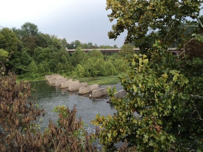
Not to be disrespectful of your info but merely to help with facts . The picture shown of the concrete imbuttments across the river are actually the pier foundations for the railroad bridge that used to be here . The covered bridge imbuttments are probably what you walked up onto to take this picture . The bridge itself spanned the river from bank to bank over the dam which was part of the canal system . The covered bridge was rebuilt after the war and remained in service until approx. 1932 . The railroad bridge was in service until the flood of 1969 which ended rail service to Lexington permanately .
— Submitted December 22, 2012, by John Calhoun of Charlotte, North Carolina.
Photographed by Bill Coughlin, August 20, 2012
5. Covered Bridge Stone Abutments
These abutments are all that remain of the covered bridge that was torched by Confederate Gen. John McCausland on June 11, 1864.
Internet Archive
6. Margaret J. Preston
From American Authors by Mildred Lewis Rutherford, 1894.

Photographed by Bradley Owen, August 12, 2024
7. Jordan's Point Historic District Marker
Credits. This page was last revised on April 26, 2026. It was originally submitted on August 20, 2012, by Bill Coughlin of Woodland Park, New Jersey. This page has been viewed 1,768 times since then and 50 times this year. Photos: 1. submitted on August 20, 2012, by Bill Coughlin of Woodland Park, New Jersey. 2. submitted on August 12, 2024, by Bradley Owen of Morgantown, West Virginia. 3, 4, 5. submitted on August 20, 2012, by Bill Coughlin of Woodland Park, New Jersey. 6. submitted on January 15, 2021, by Allen C. Browne of Silver Spring, Maryland. 7. submitted on August 13, 2024, by Bradley Owen of Morgantown, West Virginia.
