Near Bolivar in Jefferson County, West Virginia — The American South (Appalachia)
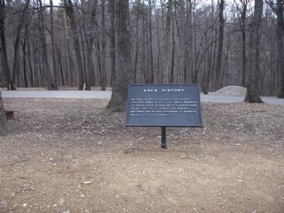
Area History
On April 18, 1861 Confederate volunteers occupied these heights. The threat prompted Lt. Roger Jones, in command at Harpers Ferry, to set fire to the armory and arsenal buildings destroying thousands of muskets needed by the Confederacy.
Topics. This historical marker is listed in this topic list: War, US Civil. A significant historical month for this entry is April 1765.
Location. 39° 18.858′ N, 77° 45.894′ W. Marker is near Bolivar, West Virginia, in Jefferson County. Marker can be reached from Campground Road. Marker is located in the Harpers Ferry KOA Campground. Touch for map. Marker is at or near this postal address: 343 Campground Road, Harpers Ferry WV 25425, United States of America. Touch for directions.
Other nearby markers. At least 8 other markers are within walking distance of this marker. Sheridan Fortifications (a few steps from this marker); First Major Action (about 400 feet away, measured in a direct line); The Abatis (about 400 feet away); Infantry Positions (about 500 feet away); Gun Position #6 (approx. 0.2 miles away); From Civil War to Civil Rights / Battle of Harpers Ferry (approx. ¼ mile away); Home Becomes Battlefield (approx. ¼ mile away); The Fate of Harpers Ferry was sealed. (approx. 0.3 miles away). Touch for a list and map of all markers in Bolivar.
Also see . . . Harpers Ferry Armory & Arsenal. Harpers Ferry National Historical Park website entry (Submitted on March 1, 2008.)
Credits. This page was last revised on February 2, 2022. It was originally submitted on March 1, 2008. This page has been viewed 1,250 times since then and 43 times this year. Photos: 1, 2. submitted on March 1, 2008. • Craig Swain was the editor who published this page.

