Cape Girardeau in Cape Girardeau County, Missouri — The American Midwest (Upper Plains)
The Red House
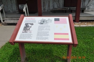
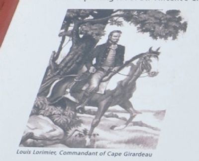
The Red House served as the family home for Louis, his wife Charlotte Pemanpieh Bougainville, and their children- Guillaume ( as son from a previous marriage), Louis, Jr., Marie Louise, Augustus Bougainville, Agatha, Vernieul Raphael, and Victor. It also served as a fur-trading establishment and as the seat of government for the Spanish district of Cape Girardeau, of which the Spanish district of Cape Girardeau, of which Lorimier was commandant.
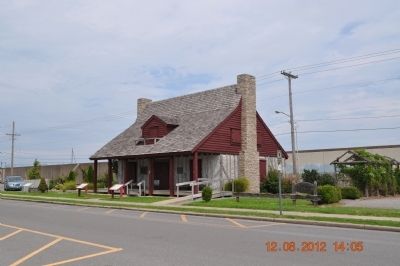
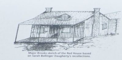
Constructed in typical Mississippi Valley French colonial architectural style, the building featured vertical log poteaux sur sole (post on a sill) construction, with a steep hip roof which broadened to cover wide porches. The porches provided a sheltered work area and shaded the windows from the sun which cooled the interior.
After the Louisiana Purchase and the transfer of authority of the United States government in 1804, the Red House was no longer a seat of government, but continued to be an important trading post. After his wife's death in 1808, Lorimier remarried. Marie Berthiaume, his third wife, bore him one child, a son Manuel who died in childhood. Lorimier died at his home on June 26, 1812.
Ownership of the Red House changed several times before the property was acquired by the Catholic Church. The house was destroyed by a tornado on November 27, 1850.
Topics. This historical marker is listed in this topic list: Colonial Era. A significant historical month for this entry is June 1863.
Location. 37° 18.049′ N, 89° 31.124′ W. Marker is in Cape Girardeau, Missouri, in Cape Girardeau County. Marker is on South Main Street, on the right when traveling south. Located in front of the Red House Museum last marker to the far right. Touch for map. Marker is at or near this postal address: 128 South Main Street, Cape Girardeau MO 63701, United States of America. Touch for directions.
Other nearby markers. At least 8 other markers are within walking distance of this marker. George Drouillard (here, next to this marker); The Red House Interpretive Center (here, next to this marker); The Lewis and Clark Expedition Across Missouri (a few steps from this marker); Old St. Vincent's Church (within shouting distance of this marker); 1925 (within shouting distance of this marker); B'nai Israel Synagogue (within shouting distance of this marker); 1964 (within shouting distance of this marker); Cape La Croix Creek (within shouting distance of this marker). Touch for a list and map of all markers in Cape Girardeau.

Photographed By Sandra Hughes, August 12, 2012
5. The Red House Marker
1793 ~1799
The Red House
This area between El Camino Real and Aquamsi Front along the river was the site occupied by the Red House (La Casa Roja) Home and trading post of The city's founder, Don Louis Lorimier.
Mecca for both whites and indians of the region and a welcome haven for travelers. It was the civil, social, and military headquarters of the district under three regions - Spanish, French and American.
Rotary
International
(marker across the street next to church parking lot.)
Credits. This page was last revised on June 16, 2016. It was originally submitted on August 23, 2012, by Sandra Hughes Tidwell of Killen, Alabama, USA. This page has been viewed 555 times since then and 15 times this year. Photos: 1, 2, 3, 4, 5. submitted on August 23, 2012, by Sandra Hughes Tidwell of Killen, Alabama, USA. • Craig Swain was the editor who published this page.


