Buckhannon in Upshur County, West Virginia — The American South (Appalachia)
McClellan's Buckhannon Camp
Prelude to Rich Mountain
— The First Campaign —
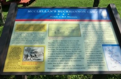
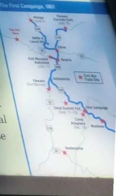
In one of the first important Union victories of the Civil War, on July 11, 1861, Union Gen. George B. McClellan’s forces defeated part of Confederate Gen. Robert S Garnett’s command east of here at Rich Mountain. McClellan’s column camped here early in July before the battle.
On July 2, McClellan wrote to his wife, Mary Ellen McClellan, that his column was marching to Buckhannon after a series of hard rains and that the local people rejoiced to see his troops. The next day he wrote to her about how cold it was the night before, the first night of camp in Buckhannon. McClellan also sent numerous telegrams to Washington, D.C., complaining about the lack of supplies and describing his intention to defeat Garnett by maneuvers rather than by direct attack.
McClellan’s subordinate, Gen. William S. Rosecrans, arrived here with his command earlier than anticipated. It earned him McClellan’s wrath for fear the Rosecrans’s early march had alerted the Confederates. McClellan’s column eventually marched out of town along the Staunton and Parkersburg Turnpike (Main Street in Buckhannon) to Rich Mountain. Ironically, it was Rosecrans’s direct attack there that secured McClellan’s reputation and the appointment to command the Army of the Potomac.
Buckhannon and Upshur County remained largely Unionist during the war. While southern sympathizers were active here, many moved south early in the conflict. Overt signs of support for one side or the other depended on whether Confederate or Federal troops were in the area. Brothers in several local families joined opposite sides in the conflict.
(Sidebar): After Samuel Morse invented the telegraph in 1844, wires soon were strung all along the East Coast. During the Civil War, 15,000 miles of telegraph cable was laid purely for military purposes. Mobile telegraph wagons reported and received communications from just behind the front lines. McClellan, who relied heavily on the telegraph during the Civil War, extended wires to Rich Mountain. This was one of the earliest uses of the telegraph in the field.
Erected by West Virginia Civil War Trails.
Topics and series. This historical marker is listed in this topic list: War, US Civil. In addition, it is included in the West Virginia Civil War Trails series list. A significant historical month for this entry is July 1861.
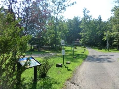
Location. 38° 59.166′ N, 80° 13.788′ W. Marker is in Buckhannon, West Virginia, in Upshur County. Marker is at the intersection of Park Street and Gum Street, on the right when traveling south on Park Street. Touch for map. Marker is at or near this postal address: 25 Park Street, Buckhannon WV 26201, United States of America. Touch for directions.
Other nearby markers. At least 8 other markers are within walking distance of this marker. Jenkins in Buckhannon (approx. 0.4 miles away); The West Virginia Strawberry Festival (approx. 0.4 miles away); In Tribute to and in Memory of Buckhannon Volunteer Fire Department, Inc. (approx. half a mile away); Veterans Memorial (approx. half a mile away); Honor Roll (approx. half a mile away); Operation Desert Storm Memorial (approx. half a mile away); Buckhannon / Frontier Days (approx. half a mile away); Upshur County Courthouses / Rainbow Restaurant (approx. half a mile away). Touch for a list and map of all markers in Buckhannon.
Credits. This page was last revised on June 16, 2016. It was originally submitted on August 24, 2012, by Don Morfe of Baltimore, Maryland. This page has been viewed 693 times since then and 21 times this year. Photos: 1. submitted on August 24, 2012, by Don Morfe of Baltimore, Maryland. 2. submitted on September 2, 2012, by Don Morfe of Baltimore, Maryland. 3. submitted on September 10, 2012, by Don Morfe of Baltimore, Maryland. • Craig Swain was the editor who published this page.


