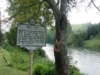
Sutton in Braxton County, West Virginia — The American South (Appalachia)
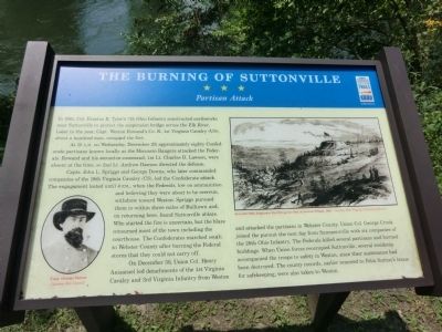
The Burning of Suttonville
Partisan Attack
At 10 A.M. on Wednesday, December 29, approximately eighty Confederate partisans known locally as the Moccasin Rangers attacked the Federals. Rowand and his second-in-command, 1st Lt. Charles D. Lawson were absent at the time, so 2nd Lt. Andrew Dawson directed the defense.
Capts. John L. Spriggs and George Down, who later commanded companies of the 19th Virginia Cavalry (CS), led the Confederate attack. The engagement lasted until 4 P.M., when the Federals, low on ammunition and believing they were about to be overrun, withdrew toward Weston. Spriggs pursued them to within three miles of Bulltown and, on returning here, found Suttonville ablaze. Who stated the fire is uncertain, but the blaze consumed most of the town including the courthouse. The Confederates marched south to Webster County after burning the Federal stores that they could not carry off.
On December 30, Union Col. Henry Anisansel led detachments of the 1st Virginia Cavalry and 3rd Virginia Infantry from Weston and attacked the partisans in Webster County. Union Col. George Crook joined the pursuit the next day from Summersville with six companies of the 26th Ohio Infantry. The Federals killed several partisans and burned buildings. When Union forces reoccupied Suttonville, several residents accompanied the troops to safety in Weston since their sustenance had been destroyed. The county records, earlier removed to Felix Sutton’s house for safekeeping, were also taken to Weston.
Erected by West Virginia Civil War Trails.
Topics and series. This historical marker is listed in this topic list: War, US Civil. In addition, it is included in the West Virginia Civil War Trails series list. A significant historical date for this entry is December 29, 1863.
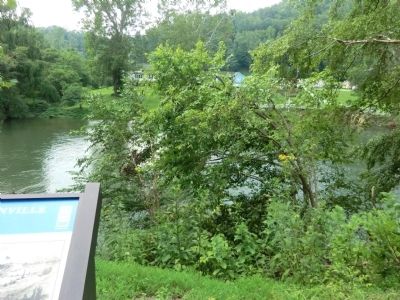
Location. This marker has been replaced by another marker nearby. It was located near 38° 39.984′ N, 80° 42.918′ W. Marker was in Sutton, West Virginia, in Braxton County. Marker was at the intersection of Main Street and Camden Avenue (West Virginia Highway 4), on the right when traveling east on Main Street. Touch for map. Marker was at or near this postal address: 128 Main Street, Sutton WV 26601, United States of America. Touch for directions.
Other nearby markers. At least 8 other markers are within 9 miles of this location, measured as the crow flies. Burning of Sutton (a few steps from this marker); Fighting and Flames (a few steps from this marker); The War and Suttonville (approx. 0.4 miles away); How Did Braxton County Get Its Name? (approx. 0.4 miles away); World War 1917–18 Memorial (approx. 0.4 miles away); Revolutionary War Monument (approx. 0.4 miles away); Geographic Center (approx. 3.2 miles away); Skirmish at Salt Lick Bridge (approx. 8.9 miles away). Touch for a list and map of all markers in Sutton.
More about this marker. This marker was replaced by one named "Fighting and Flames" with slightly different narrative.
Credits. This page was last revised on October 18, 2022. It was originally submitted on August 24, 2012, by Don Morfe of Baltimore, Maryland. This page has been viewed 1,015 times since then and 35 times this year. Photos: 1, 2, 3, 4, 5. submitted on August 24, 2012, by Don Morfe of Baltimore, Maryland. • Craig Swain was the editor who published this page.
