Bristow in Prince William County, Virginia — The American South (Mid-Atlantic)
Roads to Bristoe Station
Bristoe Station
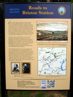
On August 9, Jackson attacked Pope’s 2nd Corps at Cedar Mountain near Culpeper but the timely arrival of Union reinforcements forced Jackson’s withdrawal. Shortly afterward Lee became aware that McClellan’s army had left the Peninsula under orders to move northward and join forces with Pope. The threat to Richmond removed, Lee reacted swiftly and marched his 55,000 men to join Jackson with the intention of concentrating his entire army against Pope before McClellan’s nearly 90,000 reinforcements could arrive.
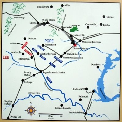
After skirmishing with Pope’s army along the Rappahannock River, Lee boldly divided his forces, sending Jackson’s wing around the western flank of Pope’s Rappahannock line to cut his communications somewhere along the Orange and Alexandria Railroad. This action would force Pope’s retreat and give Lee the opportunity to maneuver into a favorable position to destroy Pope’s army. The balance of Lee’s army, Maj. Gen. James Longstreet’s wing, would remain in the front of Pope during this operation. In a matter of two days, Jackson’s “foot cavalry” marched 56 miles through fields, streams and mountains to strike the railroad here, at Bristoe Station.
Erected 2012 by Prince William County Department of Public Works, Historic Preservation Division.
Topics. This historical marker is listed in this topic list: War, US Civil. A significant historical month for this entry is June 1862.
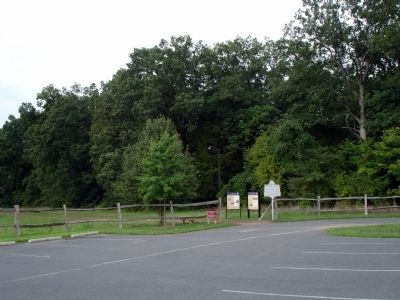
Location. 38° 43.615′ N, 77° 32.679′ W. Marker is in Bristow, Virginia, in Prince William County. Marker can be reached from Iron Brigade Unit Avenue. Marker is located at edge of the parking lot at the Bristoe Station Battlefield Heritage Park. Touch for map. Marker is in this post office area: Bristow VA 20136, United States of America. Touch for directions.
Other nearby markers. At least 8 other markers are within walking distance of this marker. Bristoe 1861-1862 Trail (here, next to this marker); Confederate Cemeteries (within shouting distance of this marker); Bristoe Station Battlefield Heritage Park (within shouting distance of this marker); Bristoe 1863 Trail (within shouting distance of this marker); Lee's Last Move North: The Bristoe Station Campaign of 1863 (within shouting distance of this marker); Federal Winter Quarter (about 300 feet away, measured in a direct line); Camp Jones (about 300 feet away); Lee Catches Meade (about 500 feet away). Touch for a list and map of all markers in Bristow.
More about this marker. The lower left of the marker displays two portraits captioned (Left) General Thomas "Stonewall" Jackson, C.S.A. and (Right) General John Pope, U.S.A. Courtesy of The Library of Congress.
On the upper right of the marker is a sketch captioned Robert Knox Sneden of the 40th New York Volunteer Infantry Regiment served as a quartermaster and one of the war's most prolific mapmakers. He sketched this image of Bristoe Battlefied in 1862, and later became a landscape painter. Courtesy of the Virginia Historical Society.
On the right side of the marker is a map captioned Situation in Virginia on August 24, 1862
The bottom of the marker includes the Virginia Civil War Trails Bugle Logo and a QR Code.
Credits. This page was last revised on June 10, 2020. It was originally submitted on September 2, 2012. This page has been viewed 662 times since then and 19 times this year. Photos: 1, 2, 3. submitted on September 2, 2012. • Craig Swain was the editor who published this page.


