Charleston in Kanawha County, West Virginia — The American South (Appalachia)
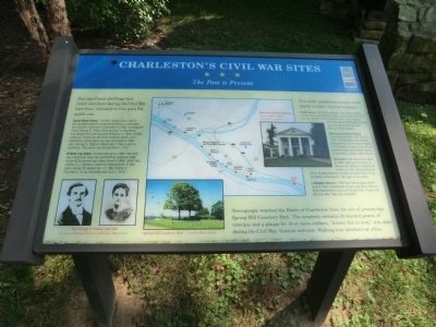
Charleston's Civil War Sites
The Past is Present
Two significant dwellings that stood elsewhere during the Civil War have been relocated to this park for public use:
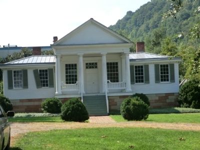
Craik-Patton House. The Rev. James Craik, son of George Washington’s personal secretary, constructed this house in downtown Charleston in 1834. Subsequent owner George S. Patton practiced law in Charleston and helped form the Kanawha Riflemen in 1856. Confederate Col. Patton led the 22nd Virginia infantry with distinction before being mortally wounded in 1864. Gen George S. Patton of World War II fame was his grandson. The house was moved here in 1973.
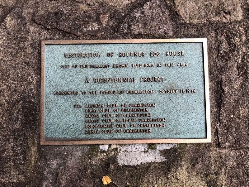
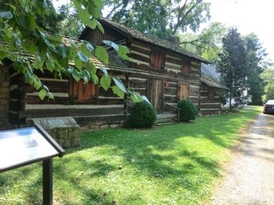
Ruffner Log Cabin. Constructed about 1800, the cabin was uncovered when the Joel Ruffner estate at 1536 Kanawha Boulevard was taken down in 1969. Union Gen. Joseph A.J. Lightburn made his headquarters in this cabin during the September 13, 1862, Battle of Charleston. It was reconstructed here in 1976.
Four other antebellum houses stand nearby in their original locations:
Cedar Grove, 1506 Kanawha Blvd, East. Built in 1834, it was once surrounded by stately cedar trees. This farm was the westernmost of three Ruffner family estates along the James River and Kanawha Turnpike during the Civil War. Not open to the public.
McFarland-Hubbard House, 1310 Kanawha Blvd, East. Built in 1836. A Confederate cannonball damaged the roof during the Battle of Charleston. Visitors may see the projectile during the West Virginia Humanities Council’s office hours.
Glenwood, 800 Orchard St. Built in 1852, Fighting took place in Glenwood’s fields as Confederate artillery on Fort Hill harassed the Union forces retreating through the West Side during the Battle of Charleston. Not open to the public.
Littlepage Mansion, 1809 West Washington Street. Built in 1845. Confederated forces under Gen. Henry A. Wise established a camp on the grounds. Please visit this Civil War Trails site for details. Townspeople watched the Battle of Charleston from the site of present-day Spring Hill Cemetery Park. The cemetery contains 24 marked graves of veterans and a plaque for 10 or more soldiers, "known but to God," who died during the Civil War. Visitors welcome. Walking tour brochure at office.
Erected by West Virginia Civil War Trails.
Topics and series. This historical marker is listed in this topic list: War, US Civil. In addition, it is included in the West Virginia Civil War Trails series list. A significant historical month for this entry is September 1899.
Location. 38° 19.908′ N, 81° 35.106′ W. Marker is in Charleston, West Virginia, in Kanawha County. Marker is on Kanawha Boulevard. Touch for map. Marker is at or near this postal address: 2949 Kanawha Boulevard East, Charleston WV 25311, United States of America. Touch for directions.
Other nearby markers. At least 8 other markers are within 2 miles of this marker, measured as the crow flies. H. Bernard Wehrle, Sr. (within shouting distance of this marker); Craik-Patton House (about 300 feet away, measured in a direct line); Daniel Boone (about 500 feet away); Lewis’ March (approx. 1.2 miles away); West Virginia Home Guards (approx. 1.4 miles away); Thomas J. Jackson (approx. 1.4 miles away); The New Deal In Your Community (approx. 1.4 miles away); Dedicated to You, A Free Citizen in a Free Land (approx. 1½ miles away). Touch for a list and map of all markers in Charleston.

Photographed By Devry Becker Jones (CC0), July 31, 2021
4. Restoration plaque for the Ruffner Log House
Credits. This page was last revised on August 5, 2021. It was originally submitted on September 3, 2012, by Don Morfe of Baltimore, Maryland. This page has been viewed 1,038 times since then and 49 times this year. Photos: 1, 2. submitted on September 3, 2012, by Don Morfe of Baltimore, Maryland. 3. submitted on September 4, 2012, by Don Morfe of Baltimore, Maryland. 4. submitted on August 5, 2021, by Devry Becker Jones of Washington, District of Columbia. • Craig Swain was the editor who published this page.


