Charleston in Kanawha County, West Virginia — The American South (Appalachia)
Military Occupation
A Bitter Pill to Swallow
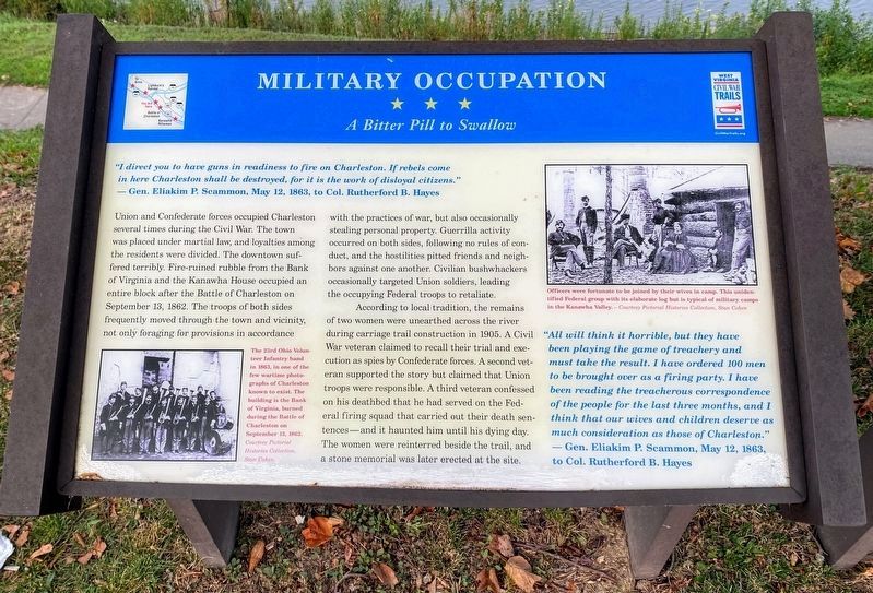
"I direct you to have guns in readiness to fire on Charleston. If rebels come in here Charleston shall be destroyed, for it is the work of disloyal citizens." - Gen. Eliakim P. Scammon, May 112, 1863, to Col. Rutherford B. Hayes.
Union and Confederate forces occupied Charleston several times during the Civil War. The town was placed under martial law, and loyalties among the residents were divided. The downtown suffered terribly. Fire-ruined rubble from the Bank of Virginia and the Kanawha House occupied and entire block after the Battle of Charleston on September 13, 1862. The troops of both sides frequently moved through the town and vicinity, not only foraging for provision is accordance with the practices of war, but also occasionally stealing personal property,. Guerrilla activity occurred on both sides, following no rules of conduct, and the hostilities pitted friends and neighbors against one another. Civilian bushwhackers occasionally targeted Union soldiers, leading the occupying Federal troops to retaliate.
According to local tradition, the remains of two women were unearthed across the river during carriage trail construction in 1905. A Civil War veteran claimed to recall their trial and execution as spies by Confederate forces. A second veteran supported the story but claimed that Union troops were responsible. A third veteran confessed on his deathbed that he had served on the Federal firing squad that carried out their death sentences---and it haunted him until his dying day. The women were reinterred beside the trail, and a stone memorial was later erected at the site.
"All will think it horrible, but they have been playing the game of treachery and must take the result. I have ordered 100 men to be brought over as a firing party. I have been reading the treacherous correspondence of the people for the last three months, and I think that our wives and children deserve as much consideration as those of Charleston."
Gen. Eliakim P. Scammon, May 12, 1863, to Col. Rutherford B. Hayes
Erected by West Virginia Civil War Trails.
Topics and series. This historical marker is listed in this topic list: War, US Civil. In addition, it is included in the Former U.S. Presidents: #19 Rutherford B. Hayes, and the West Virginia Civil War Trails series lists. A significant historical year for this entry is 1863.
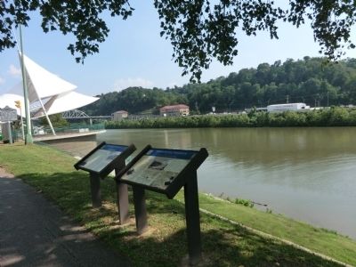
Location. 38° 21.042′ N, 81° 38.388′ W. Marker is in Charleston, West Virginia, in Kanawha County. Marker is at the intersection of Kanawha Boulevard and Court Street on Kanawha Boulevard. Touch for map. Marker is at or near this postal address: 471 Kanawha Boulevard East, Charleston WV 25301, United States of America. Touch for directions.
Other nearby markers. At least 8 other markers are within walking distance of this marker. Presidential Presence (here, next to this marker); Charleston (a few steps from this marker); Victims of July 19, 1961 Flood (about 400 feet away, measured in a direct line); Kanawha County Formed November 14, 1788 (about 400 feet away); The New Deal In Your Community (approx. ¼ mile away); Kanawha County Public Library (approx. ¼ mile away); State Capitol Annex (approx. 0.3 miles away); South Side Bridge (approx. 0.3 miles away). Touch for a list and map of all markers in Charleston.
Credits. This page was last revised on August 12, 2021. It was originally submitted on September 3, 2012, by Don Morfe of Baltimore, Maryland. This page has been viewed 688 times since then and 11 times this year. Photos: 1. submitted on August 12, 2021, by Shane Oliver of Richmond, Virginia. 2, 3. submitted on September 3, 2012, by Don Morfe of Baltimore, Maryland. • Craig Swain was the editor who published this page.


