
Fayetteville in Fayette County, West Virginia — The American South (Appalachia)
Battle of Fayetteville
Defense and Retreat
Photographed by Don Morfe, August 4, 2012
1. Battle of Fayetteville Marker
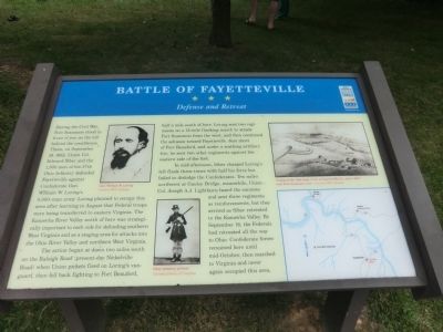
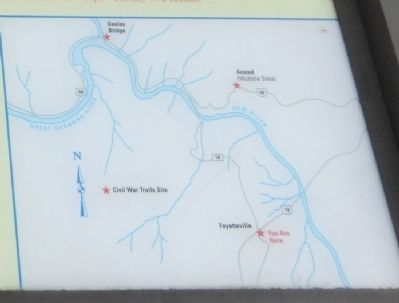
The action began at dawn two miles south on the Raleigh Road (present-day Nickelville Road) when Union pickets fired on Loring’s vanguard, then fell back fighting to Fort Beauford, half a mile south of here. Loring sent two regiments on a 13-mile flanking march to attack Fort Scammon from the west, and then continued the advance toward Fayetteville. Just short of Fort Beauford, and under a scathing artillery fire, he sent two other regiments against the eastern side of the fort.
In mid-afternoon, Siber charged Loring’s left flank
this page online
Erected by West Virginia Civil War Trails.
Topics and series. This historical marker is listed in these topic lists: Forts and Castles • War, US Civil. In addition, it is included in the West Virginia Civil War Trails series list. A significant historical date for this entry is September 10, 1862.
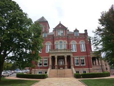
Location. This marker has been replaced by another marker nearby. It was located near 38° 3.178′ N, 81° 6.233′ W. Marker was in Fayetteville, West Virginia, in Fayette County. It was at the intersection of North Court Street (State Highway 16) and East Maple Avenue, on the right when traveling north on North Court Street. This marker is on the Courthouse lawn. Touch for map. Marker was at or near
Photographed by Don Morfe, August 4, 2012
2. Battle of Fayetteville Marker

Regionally, this marker was in the New River Gorge and in Greater Charleston Area. It was also in the American South, specifically in the Upper South, in Appalachia, and specifically in Southern Appalachia. Globally, it was in North America, the Western Hemisphere, the Western World, and the Anglosphere. Historically, it found itself in what was once the territory of the Mississippian Culture.
Other nearby markers. At least 8 other markers are within walking distance of this location: A different marker also named Battle of Fayetteville (here, next to this marker); Marquis de Lafayette (a few steps from this marker); Fayetteville (a few steps from this marker); Abraham Vandal (within shouting distance of this marker); Fayette County Law Enforcement Officers' Memorial (within shouting distance of this marker); Morris Harvey House (about 500 feet away, measured in a direct line); American Legion Post 149 Veterans Memorial Torch (about 500 feet away); Fayette County Soldiers & Sailers Memorial Building (about
Photographed by Don Morfe, August 4, 2012
3. Battle of Fayetteville Marker
Related marker. Click here for another marker that is related to this marker. New Replacement CWT Marker At This Location also titled "Battle of Fayetteville".
Credits. This page was last revised on December 11, 2024. It was originally submitted on September 6, 2012, by Don Morfe of Baltimore, Maryland. This page has been viewed 2,305 times since then and 85 times this year. Photos: 1, 2. submitted on September 6, 2012, by Don Morfe of Baltimore, Maryland. 3. submitted on September 10, 2012, by Don Morfe of Baltimore, Maryland. • Craig Swain was the editor who published this page.
