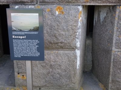
Harbor Islands- Long Island in Boston in Suffolk County, Massachusetts — The American Northeast (New England)
Escape!
Topics. This historical marker is listed in these topic lists: Forts and Castles • War, US Civil. A significant historical month for this entry is October 1863.
Location. 42° 19.266′ N, 70° 55.753′ W. Marker is in Boston, Massachusetts, in Suffolk County. It is on Harbor Islands- Long Island. Marker is located on the West side of Fort Warren on Georges Island. Touch for map. Marker is in this post office area: Hull MA 02045, United States of America. Touch for directions.
Other nearby markers. At least 8 other markers are within walking distance of this marker. Defense System (within shouting distance of this marker); Fort Warren (about 300 feet away, measured in a direct line); Confederate POWs (about 500 feet away); Coastal Mines (about 500 feet away); Powder Magazine (about 600 feet away); Parade Ground (about 600 feet away); Bakery (about 600 feet away); Political Prisoners (about 700 feet away). Touch for a list and map of all markers in Boston.
Credits. This page was last revised on June 23, 2023. It was originally submitted on September 7, 2012, by Bryan Simmons of Attleboro, Massachusetts. This page has been viewed 598 times since then and 8 times this year. Photo 1. submitted on September 7, 2012, by Bryan Simmons of Attleboro, Massachusetts. • Bill Pfingsten was the editor who published this page.
Editor’s want-list for this marker. A wide shot of the marker and its surroundings. • Can you help?
