Kingston in Ulster County, New York — The American Northeast (Mid-Atlantic)
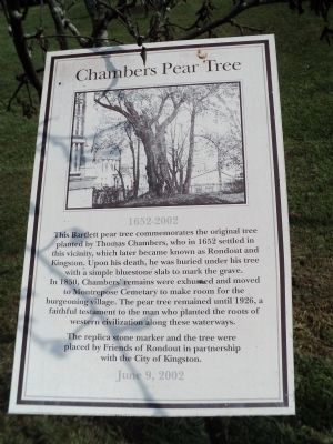
Chambers Pear Tree
1652 - 2002
In 1850, Chambers’ remains were exhumed and moved to Montrepose Cemetery to make room for the burgeoning village. The pear tree remained until 1926, a faithful testament to the man who planted he roots of western civilization along these waterways.
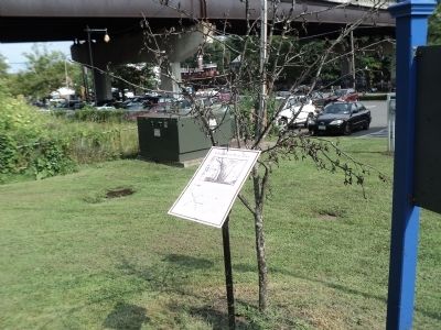
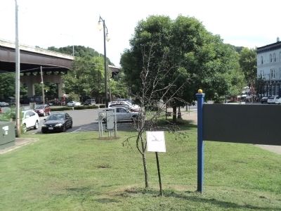
The replica stone marker and the tree were placed by Friends of Rondout in partnership with the City of Kingston.
June 9, 2002
Erected 2002 by Friends of Rondout and the City of Kingston.
Topics. This historical marker is listed in these topic lists: Cemeteries & Burial Sites • Settlements & Settlers. A significant historical month for this entry is June 1987.
Location. 41° 55.126′ N, 73° 58.971′ W. Marker is in Kingston, New York, in Ulster County. Marker is on Broadway north of Strand Street, on the right when traveling north. Marker is located in front of the Kingston Heritage Area Visitor Center. Touch for map. Marker is in this post office area: Kingston NY 12401, United States of America. Touch for directions.
Other nearby markers. At least 8 other markers are within walking distance of this marker. Rondout (within shouting distance of this marker); New York State’s Heritage Area System (within shouting distance of this marker); 20th New York State Militia (about 300 feet away, measured in a direct line); Navy Seabees (about 300 feet away); Louis Caterino (about 300 feet away); The Delaware and Hudson Canal (about 300 feet away); Island Dock (about 300 feet away); The Mary Powell: Queen Of The Hudson (about 300 feet away). Touch for a list and map of all markers in Kingston.
More about this marker. A photo of the standing pear tree appears at the top of the marker.
Credits. This page was last revised on June 16, 2016. It was originally submitted on September 7, 2012, by Bill Coughlin of Woodland Park, New Jersey. This page has been viewed 457 times since then and 13 times this year. Photos: 1, 2, 3. submitted on September 7, 2012, by Bill Coughlin of Woodland Park, New Jersey.


