Historic District - North in Savannah in Chatham County, Georgia — The American South (South Atlantic)
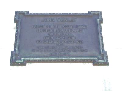
John Wesley
erected by Oglethorpe
on this lot,
from May 9, 1736
to November 27, 1737 (OS)
–•–
This tablet is here placed
on the bi-centenary of his birth
June 28, 1903
Erected 1903 by City of Savannah.
Topics. This historical marker is listed in these topic lists: Churches & Religion • Colonial Era. A significant historical month for this entry is May 1779.
Location. 32° 4.682′ N, 81° 5.612′ W. Marker is in Savannah, Georgia, in Chatham County. It is in the Historic District - North. Marker is on Whitaker St near W. York St, on the left when traveling south. Rear side of the Federal Building/US Courthouse in Savannah, near the loading dock, mounted on a wall about 8 feet up. Touch for map. Marker is at or near this postal address: 125-127 Bull Street, Savannah GA 31402, United States of America. Touch for directions.
Other nearby markers. At least 8 other markers are within walking distance of this marker. Federal Building and U.S. Courthouse (within shouting distance of this marker); Savannah's First Burying Ground (within shouting distance of this marker); Tomo-Chi-Chi's Grave (about 400 feet away, measured in a direct line); Independent Presbyterian Church (about 400 feet away); Original 1733 Burial Plot (about 500 feet away); George Washington (about 500 feet away); Tondee's Tavern (about 500 feet away); James Moore Wayne, 1790-1867 (about 500 feet away). Touch for a list and map of all markers in Savannah.
Related markers. Click here for a list of markers that are related to this marker. To better understand the relationship, study markers shown.
Credits. This page was last revised on February 8, 2023. It was originally submitted on March 3, 2008, by Mike Stroud of Bluffton, South Carolina. This page has been viewed 1,390 times since then and 24 times this year. Photos: 1, 2, 3. submitted on March 3, 2008, by Mike Stroud of Bluffton, South Carolina. • Kevin W. was the editor who published this page.


