Near Strasburg in Shenandoah County, Virginia — The American South (Mid-Atlantic)
Fort Bowman
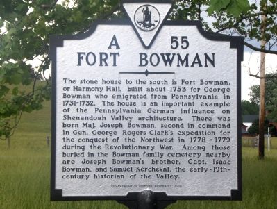
Photographed by Roger Dean Meyer, June 3, 2006
1. Fort Bowman Marker
Erected 1998 by Department of Historic Resources. (Marker Number A-55.)
Topics and series. This historical marker is listed in these topic lists: Architecture • Cemeteries & Burial Sites • Education • Exploration • Forts and Castles • Settlements & Settlers • War, US Revolutionary. In addition, it is included in the Virginia Department of Historic Resources (DHR) series list. A significant historical year for this entry is 1753.
Location. 39° 0.421′ N, 78° 19.163′ W. Marker is near Strasburg, Virginia, in
this page online

Regionally, this marker is in Virginia’s Shenandoah Valley. It is also in the American South, specifically in the Upper South, and in the Mid-Atlantic. Globally, it is in North America, the Western Hemisphere, the Western World, and the Anglosphere. Historically, it finds itself in what was once the territory of the Mississippian Culture, one of the original Thirteen Colonies, one of the Confederate States of America, and the Antebellum South.
Other nearby markers. At least 5 other markers are within walking distance of this marker: Cedar Creek (here, next to this marker); a different marker also named Cedar Creek (here, next to this marker); Frederick County / Shenandoah County (approx. 0.2 miles away); Samuel Kercheval (approx. half a mile away); 128th Regt N.Y.S.V.I. (approx. half a mile away). Touch for a list and map of all markers
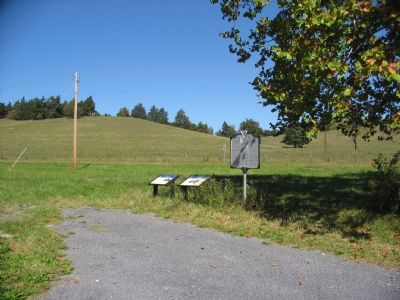
Photographed by Craig Swain, September 29, 2007
2. Three Markers in the Median of the Valley Pike
More about this marker. This marker replaced an older marker with the same title and number that read The stone house to the south is Fort Bowman, or Harmony Hall, built about 1753. Here was born Major Joseph Bowman, second in command in George Rogers Clark’s expedition for the conquest of the Northwest..
Additional commentary.
1. Location of Fort Bowman
On the map, Fort Bowman is located a short distance southwest of the marker at the end of Fort Bowman Road. However, it cannot be viewed from the marker because Interstate 81 was built between the two points.
— Submitted July 22, 2009, by Linda Walcroft of Woodstock, Virginia.
2. Additional photos?
We lived in Ft. Bowman from 1983 to 1985. If you would like some photos of the interior and exterior while we lived there, I could go through my albums and digitize a few of them for you to add to the website.
We had a wonderful experience living there, so much so that our oldest son had a painting of Harmony Hall commissioned, that hangs in his living room to this day. It was truly inspiring to look out the front door and see Massanutten Mountain
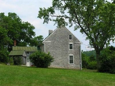
Photographed by Linda Walcroft, July 22, 2009
3. Fort Bowman
Also known as Harmony Hall
— Submitted December 6, 2016, by Jon Michael Casey of Carlisle, Pennsylvania.
Credits. This page was last revised on December 27, 2019. It was originally submitted on October 9, 2006, by Roger Dean Meyer of Yankton, South Dakota. This page has been viewed 5,978 times since then and 156 times this year. Photos: 1. submitted on October 9, 2006, by Roger Dean Meyer of Yankton, South Dakota. 2. submitted on September 30, 2007, by Craig Swain of Leesburg, Virginia. 3. submitted on July 22, 2009, by Linda Walcroft of Woodstock, Virginia. • J. J. Prats was the editor who published this page.
