Hurricane in Washington County, Utah — The American Mountains (Southwest)
Smith Mesa
Photographed by Bill Kirchner, August 28, 2012
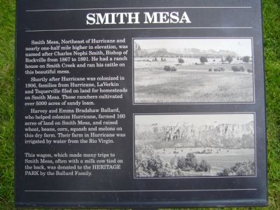
1. Smith Mesa Marker
Shortly after Hurricane was colonized in 1906, families from Hurricane, La Verkin and Toquerville filed on land for homesteads on Smith Mesa. These ranchers cultivated over 5000 acres of sandy loam.
Harvey and Emma Bradshaw Ballard, who helped colonize Hurricane, farmed 160 arches of land on Smith Mesa, and raised wheat, beans, corn, squash and melons on this dry farm. Their farm in Hurricane was irrigated by water from the Rio Virgin.
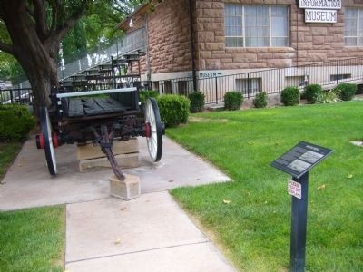
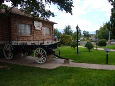
This wagon, which made many trips to Smith Mesa, often with a milk cow tied on the back, was donated to the Heritage Park by the Ballard Family.
Erected by Ballard Family.
Topics. This historical marker is listed in these topic lists: Agriculture • Settlements & Settlers. A significant historical year for this entry is 1867.
Location. 37° 10.574′ N, 113° 17.318′ W. Marker is in Hurricane, Utah, in Washington County. It can be reached from West
this page online

Regionally, this marker is in Color Country. It is also in the American Southwest, in the Mountain West, and on the Colorado Plateau. Globally, it is in North America, the Rocky Mountains, the Western Hemisphere, the Western World, and the Anglosphere. Historically, it finds itself in what was once New Spain and also Mexico’s Alta California.
Other nearby markers. At least 8 other markers are within walking distance of this marker: Survival in Utah’s Dixie (a few steps from this marker); The Roads to Utah’s Dixie (a few steps from this marker); Early Day Wood Beam Walking Hand Plow (a few steps from this marker); Pioneer Gratitude (a few steps from this marker); Hurricane City (a few steps from this marker); Dixie Peddler Wagons (a few steps from this marker); Hurricane Canal (a few steps from this marker); The Town Named After a Buggy Incident (a few steps from this marker). Touch for a list and map of all markers
Photographed by Bill Kirchner, August 28, 2012
2. Smith Mesa Marker
Photographed by Bill Kirchner, August 28, 2012
3. Smith Mesa Marker
Credits. This page was last revised on June 16, 2016. It was originally submitted on September 11, 2012, by Bill Kirchner of Tucson, Arizona. This page has been viewed 976 times since then and 50 times this year. Photos: 1, 2, 3. submitted on September 11, 2012, by Bill Kirchner of Tucson, Arizona. • Bill Pfingsten was the editor who published this page.
