
Beaufort in Beaufort County, South Carolina — The American South (South Atlantic)
Beaufort County South Carolina
Civil War and Forward
Photographed by Mike Stroud, February 2008
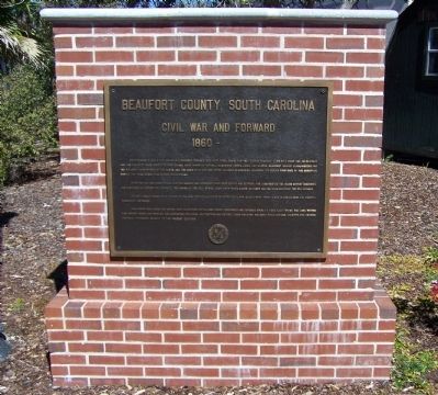
1. Beaufort County South Carolina Civil War and Forward Marker
After the war the tough-minded adapted quickly and struggled back from defeat and reprisal. The long-fibered "Sea Island Cotton" recovered and continued to support the economy. The coming of the boll weevil, some sixty years later, banished cotton forever from the sea islands. In 1892 a great storm came ashore at the high tide, piling water on water until the islands were swept clean of agriculture and shipping. Thousands drowned.
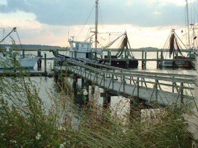
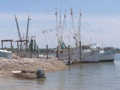
Now, where rice, indigo and cotton once flourished, cattle, feed crops, vegetables and soybeans grow. A fishing fleet " drags" the local waters for shrimp. Crabs and oysters are harvested for local consumption and export. Clean industry, military
this page online
Erected 2007 by Beaufort County.
Topics. This historical marker is listed in these topic lists: Industry & Commerce • Notable Places • War, US Civil. A significant historical month for this entry is November 1746.
Location. 32° 25.828′ N, 80° 40.383′ W. Marker is in Beaufort, South Carolina, in Beaufort County. It can be reached from Charles Street. at Riverfront Park, Between Charles and Scott Streets, alongside the Beaufort River. Touch for map. Marker is in this post office area: Beaufort SC 29902, United States of America. Touch for directions.

Regionally, this marker is in the Lowcountry and on the Sea Islands. It is also in the American South, specifically in the Deep South, and on the Eastern Seaboard. Globally, it is in the North Atlantic Region, North America, the Western Hemisphere, the Western World, and the Anglosphere. Historically, it finds itself in what was once New Spain, the territory of the Mississippian Culture, one of the original Thirteen Colonies, one of the Confederate States of America, and the Antebellum
Photographed by Mike Stroud, February 2008
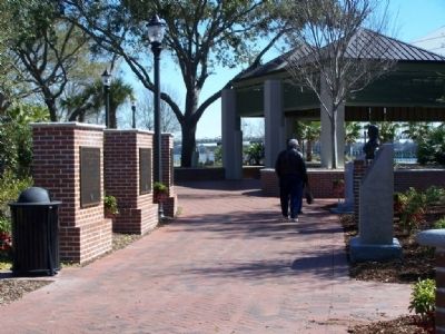
2. Riverfront park
Other nearby markers. At least 8 other markers are within walking distance of this marker: Thomas Heyward, Jr. (here, next to this marker); Beaufort County, South Carolina (here, next to this marker); a different marker also named Beaufort County, South Carolina (here, next to this marker); Freedmen's Bank Building (about 400 feet away, measured in a direct line); The William Levin Building (about 500 feet away); The Scheper-Keyserling Building (about 600 feet away); Verdier House (about 600 feet away); Lafayette's Tour (about 700 feet away). Touch for a list and map of all markers in Beaufort.
Regarding Beaufort County South Carolina. The United States Marine Corps began training recruits at Parris Island in 1915, and later in the twentieth century Hilton Head Island and neighboring sea islands have become popular resort and retirement destinations. Some famous residents of Beaufort County are naturalists Alexander Garden (ca. 1730-1791) and Stephen Elliott (1771-1830); Robert Smalls (1839-1915), a former slave who became a United States Congressman; boxer Joe Frazier; and writer Pat Conroy.
and
"in·di·go " (a). Any
Photographed by Mike Stroud, October 2004
3. Shrimp boats
The Movie Forrest Gump was filmed in Beaufort and various locations in Beaufort County
Related markers. Click here for a list of markers that are related to this marker. To better understand the relationship, study each marker in the order shown.
Photographed by Mike Stroud, circa 2006
4. Shrimping is a big local industry
Photographed by Mike Stroud, July 2007
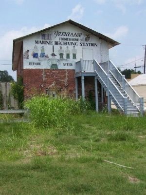
5. Former train stop at Yemassee for Parris Island recruits
Photographed by Mike Stroud, June 10, 2011
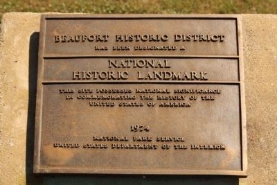
6. Beaufort Historic District: National Historic Landmark Landmark
Beaufort Historic District *** (added 1969 - - #69000159)
♦ Bounded by the Beaufort River, Bladen, Hamar, and Boundary Sts. , Beaufort
♦ Historic Significance: Architecture/Engineering, Event
♦ Architect, builder, or engineer: Unknown
♦ Architectural Style: Greek Revival, Federal
♦ Area of Significance: Military, Commerce, Politics/Government, Black, Social History, Community Planning And Development, Exploration/Settlement, Native American, Architecture
♦ Period of Significance: 1925-1949, 1900-1924, 1875-1899, 1850-1874, 1825-1849, 1800-1824, 1750-1799, 1700-1749, 1650-1699, 1600-1649, 1500-1599
♦ Owner: Local , Private
♦ Historic Function: Commerce/Trade, Domestic, Religion, Social
♦ Historic Sub-function: Business, Department Store, Meeting Hall, Religious Structure, Single Dwelling, Specialty Store
♦ Historic Significance: Architecture/Engineering, Event
♦ Architect, builder, or engineer: Unknown
♦ Architectural Style: Greek Revival, Federal
♦ Area of Significance: Military, Commerce, Politics/Government, Black, Social History, Community Planning And Development, Exploration/Settlement, Native American, Architecture
♦ Period of Significance: 1925-1949, 1900-1924, 1875-1899, 1850-1874, 1825-1849, 1800-1824, 1750-1799, 1700-1749, 1650-1699, 1600-1649, 1500-1599
♦ Owner: Local , Private
♦ Historic Function: Commerce/Trade, Domestic, Religion, Social
♦ Historic Sub-function: Business, Department Store, Meeting Hall, Religious Structure, Single Dwelling, Specialty Store
Photographed by Mike Stroud, June 10, 2011
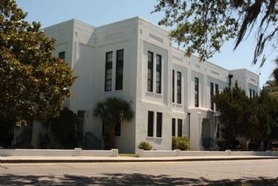
7. United States District Courthouse, Beaufort
Credits. This page was last revised on June 16, 2016. It was originally submitted on March 3, 2008, by Mike Stroud of Bluffton, South Carolina. This page has been viewed 2,140 times since then and 35 times this year. Photos: 1, 2, 3, 4, 5. submitted on March 3, 2008, by Mike Stroud of Bluffton, South Carolina. 6, 7. submitted on July 25, 2011, by Mike Stroud of Bluffton, South Carolina. • Craig Swain was the editor who published this page.
