
North Adams in Berkshire County, Massachusetts — The American Northeast (New England)
North Adams Iron Company
Battle Between the Monitor and Merrimac
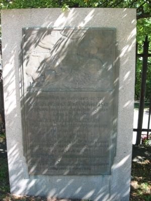
Photographed by Tony Farrick, September 16, 2012
1. North Adams Iron Company Marker
Erected by Commonwealth of Massachusetts.
Topics. This historical marker is listed in this topic list: War, US Civil. A significant historical month for this entry is March 1862.
Location. 42° 42′ N, 73° 6.898′ W. Marker is in North Adams, Massachusetts, in Berkshire County. It is on Main Street, on the right when traveling west. Touch for map. Marker is at or near this postal address: 14 Main Street, North Adams MA 01247, United States of America. Touch for directions.

Regionally, this marker is in Massachusetts’ Berkshires. It is also in the American Northeast and in New England. Globally, it is in North America, the Western Hemisphere, the Western World, and the Anglosphere. Historically, it finds itself in what
this page online
Other nearby markers. At least 8 other markers are within 5 miles of this marker, measured as the crow flies: North Adams Civil War Soldiers Monument (approx. 0.3 miles away); Veterans Memorial (approx. 2 miles away); Nehemiah Smedley House (approx. 4 miles away); a different marker also named Veterans Memorial (approx. 4.1 miles away); War and Veterans Memorial (approx. 4.2 miles away); Early Williamstown House (approx. 4.4 miles away); Williamstown Civil War Soldiers Monument (approx. 4½ miles away); Ulysses Franklin "Frank" Grant (approx. 4.6 miles away). Touch for a list and map of all markers in North Adams.
Credits. This page was last revised on June 16, 2016. It was originally submitted on September 16, 2012, by Tony Farrick of Shelburne Falls, Ma.. This page has been viewed 973 times since then and 34 times this year. Photo 1. submitted on September 16, 2012, by Tony Farrick of Shelburne Falls, Ma.. • Craig Swain was the editor who published this page.
