Appomattox in Appomattox County, Virginia — The American South (Mid-Atlantic)
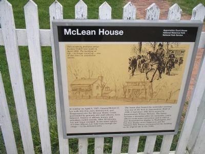
McLean House
Photographed by Bill Coughlin, April 26, 2007
1. McLean House Marker
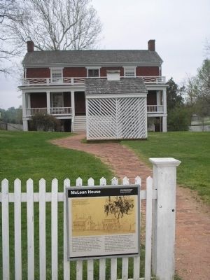
The home that hosted the surrender meeting was one of the best in Appomattox. Built in 1848, it had since 1862 been owned by businessman Wilmer McLean. The house became a sensation after the surrender. Union officers took some mementos; and in 1893 it was dismantled for display in Washington, D.C. But that display never happened, and the National Park Service reconstructed the building on its original site in the 1940s.
Erected by Appomattox Court House National Historic Park, National Park Service.
Topics. This historical marker is listed in these topic lists: Peace • War, US Civil. A significant historical month for this entry is April 1862.
Location. 37° 22.644′ N, 78° 47.832′ W. Marker is in Appomattox, Virginia, in Appomattox County.
this page online

Regionally, this marker is in the Piedmont and in Central Virginia. It is also in the American South and specifically in the Upper South. Globally, it is in North America, the Western Hemisphere, the Western World, and the Anglosphere. Historically, it finds itself in what was once the territory of the Mississippian Culture, one of the original Thirteen Colonies, one of the Confederate States of America, and the Antebellum South.
Other nearby markers. At least 8 other markers are within walking distance of this marker: Uncovering History (here, next to this marker); Lafayette W. Meeks (about 300 feet away, measured in a direct line); Anticipating Freedom (about 400 feet away); The Isbell House (about 400 feet away); Clover Hill Tavern (about 400 feet away); Clover Hill Tavern Slave Quarters (about 400 feet away);
Photographed by Bill Coughlin, April 26, 2007
2. The House where Lee surrendered the Army of Northern Virginia
Other markers no longer nearby. The McLean House (was here, next to this marker but has been replaced with another marker now near it); April 1865 (was about 500 feet away but has been permanently removed); County Jail (was about 500 feet away but has been confirmed missing).
More about this marker. The upper right of the marker features a picture of Gen. Robert E. Lee leaving the McLean House. This sketch by freelance artist Eustace Collett was made in April 1865. The building at left – no longer standing – was at that time an abandoned tavern.
Related marker. Click here for another marker that is related to this marker. This marker replaced an older one at this location also titled “The McLean House.” (Submitted on May 3, 2011, by Bill Coughlin of North Arlington, New Jersey.)
Also see . . .
1. Appomattox Court House National Historical Park. (Submitted on March 4, 2008, by Bill Coughlin of Woodland Park, New Jersey.)
2. Biography of Wilmer McLean.

3. Detail of sketch from marker
Additional commentary.
1. Wilmer McLean
At the beginning of the war, Wilmer McLean lived in Manassas, Va. After the Battle of First Manassas on July 21, 1861, McLean moved his family to Appomattox Court House, where he thought they would be isolated from the fighting. Ironically, four years later his home was selected as the site of the surrender, so a war that began in Wilmer McLean's back yard was ended in his front parlor.
— Submitted March 4, 2008, by Bill Coughlin of Woodland Park, New Jersey.
Photographed by Bill Coughlin, April 26, 2007
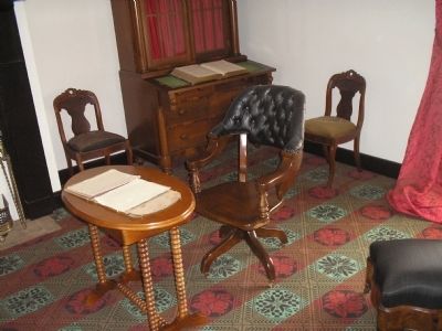
4. Wilbur McLean's parlor
In this parlor, Gen. Ulysses S. Grant accepted the surrender of the Army of Northern Virginia from Gen. Robert E. Lee. Gen. Grant sat at this desk during the ceremony.
Photographed by Bill Coughlin, April 26, 2007
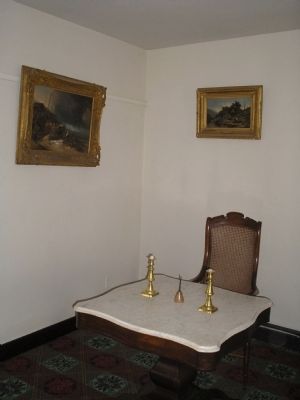
5. Inside McLean House.
Confederate Gen. Robert E. Lee signed the surrender documents on this table.
Photographed by Bill Coughlin, April 22, 2007
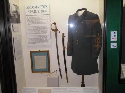
6. Gen. Lee's Surrender Uniform & Sword
When Gen. Robert E. Lee met with Gen. Ulysses S. Grant in the McLean House on April 9, 1865, he wore "a new uniform" and a "sword of considerable value." This is the actual uniform and sword that Lee wore on that day. They are on display at the Museum of the Confederacy in Richmond, Va.
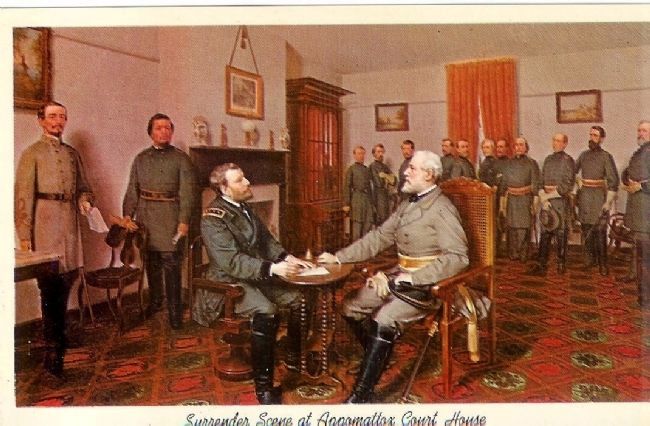
Vintage Postcard; L.M.D. Guillaume Painting at Appomattox Historical Park, circa 1893
7. Surrender scene at Appomattox Court House

Photographed by Tom Bosse, July 4, 2026
8. McLean House
Credits. This page was last revised on July 29, 2026. It was originally submitted on March 4, 2008, by Bill Coughlin of Woodland Park, New Jersey. This page has been viewed 8,992 times since then and 60 times this year. Photos: 1, 2, 3, 4, 5. submitted on March 4, 2008, by Bill Coughlin of Woodland Park, New Jersey. 6. submitted on March 14, 2008, by Bill Coughlin of Woodland Park, New Jersey. 7. submitted on September 10, 2009, by Mike Stroud of Bluffton, South Carolina. 8. submitted on July 27, 2026, by Tom Bosse of Jefferson City, Tennessee. • Craig Swain was the editor who published this page.
